
- elevation 1,014 ft (309 m) - elevation 581 ft (177 m) Basin area 321.2 km² Mouth Ohio River | - elevation 879 ft (268 m) Length 35 km Basin area 321.2 km² Country United States of America | |
 | ||
- location South of Rockport, southeastern Wood County - location northwestern Roane County - location South of Sandyville, northern Jackson County Source Wood County, West Virginia | ||
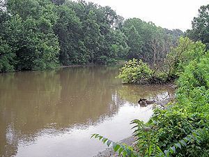
Sandy Creek is a tributary of the Ohio River in western West Virginia in the United States. Via the Ohio River, it is part of the watershed of the Mississippi River, draining an area of 124 square miles (320 km2) on the unglaciated portion of the Allegheny Plateau. The creek is 22 miles (35 km) long, or 38.3 miles (61.6 km) including its Left Fork.
Map of Sandy Creek, West Virginia, USA
Sandy Creek is formed in north-central Jackson County by the confluence of its left and right forks:
From the confluence of the left and right forks south of Sandyville, Sandy Creek flows west-northwestward, through the community of Silverton to Ravenswood, where it flows into the Ohio River from the east.
According to the West Virginia Department of Environmental Protection, approximately 80% of the Sandy Creek watershed is forested, mostly deciduous. Approximately 19% is used for pasture and agriculture, and less than 1% is urban.
According to the Geographic Names Information System, it has also been known historically as Big Sandy Creek and as Buffalo Creek. A 1906 report of the West Virginia Department of Archives transcribes the name in an unspecified Native American language as Mol-chu-con-ic-kon.