
Barangays ZIP code 2808 Local time Tuesday 12:27 PM | Time zone PST (UTC+8) Area 66.59 km² | |
 | ||
Weather 32°C, Wind W at 13 km/h, 56% Humidity | ||
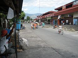
San Quintin, officially the Municipality of San Quintin (Ilocano: Ili ti San Quintin, Filipino: Bayan ng San Quintin), is a municipality in the province of Abra in the Cordillera Administrative Region (CAR) of the Philippines. The population was 5,438 at the 2015 census. In the 2016 electoral roll, it had 4,166 registered voters.
Contents
Map of San Quintin, Abra, Philippines
Geography
San Quintin is located at 17°32′N 120°31′E.
According to the Philippine Statistics Authority, the municipality has a land area of 66.59 square kilometres (25.71 sq mi) constituting 7000160000000000000♠1.60% of the 4,165.25-square-kilometre- (1,608.21 sq mi) total area of Abra.
Barangays
San Quintin is politically subdivided into 6 barangays.
Demographics
In the 2015 census, San Quintin had a population of 5,438. The population density was 82 inhabitants per square kilometre (210/sq mi).
In the 2016 electoral roll, it had 4,166 registered voters.
Products
San Quintin's main products include rice, corn, tobacco, mango and freshwater fish.