
Area 108.4 km² | Local time Monday 10:02 PM | |
 | ||
Time zone Central Standard Time (UTC-6) Weather 11°C, Wind NW at 13 km/h, 95% Humidity | ||
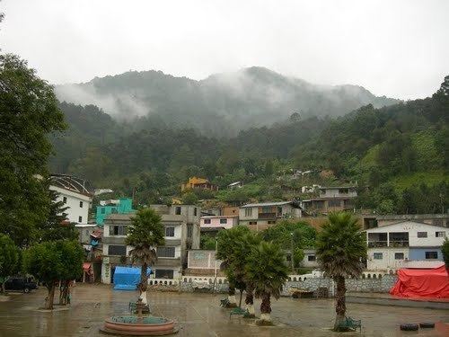
San Pedro y San Pablo Ayutla is a town and municipality in Oaxaca in south-western Mexico. It is part of the Sierra Mixe district within the Sierra Norte de Oaxaca Region.
Map of San Pedro y San Pablo Ayutla, Oaxaca, Mexico
The municipality covers an area of 108.45 km2 (41.87 sq mi) at an altitude of 2,180 meters (7,150 ft) above sea level. The climate is temperate to cool, with warmer micro-regions in the lowlands and ravines. The rainy season begins in May and ends in October with drizzle in the rest of the year. The average temperature is 16 °C (61 °F), varying from a maximum of 31 °C (88 °F) to a minimum of 2 °C (36 °F). Forest cover is pine-oak.
As of 2005, the municipality had 1,014 households with a total population of 4.319 of whom 3,639 spoke an indigenous language. The main economic activity is logging.