
Length 186 km | ||
 | ||
Main source Guatemala (El Petén)200 m (660 ft) River mouth Tributary of the Usumacinta river Discharge Average rate:52.9 m/s (1,870 cu ft/s) (at San Pedro Mactún) | ||
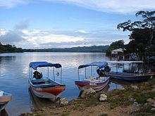
The Río San Pedro is a river of Guatemala and Mexico. Its sources are located in the Guatemalan department of El Petén. at 17.134803°N 89.902668°W / 17.134803; -89.902668 (Río San Pedro). The river flows westwards until it reaches the Mexican border and crosses into the state of Tabasco at 17.279636°N 90.987697°W / 17.279636; -90.987697 (Río San Pedro). From there it continues northwest and joins the Usumacinta River. The Guatemalan part of the San Pedro river basin covers an area of 14,335 square kilometres (5,535 sq mi).
Map of Rio San Pedro, Guatemala
References
San Pedro River (Guatemala) Wikipedia(Text) CC BY-SA