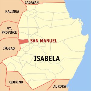
Barangays Area 112.8 km² | Founded 1957 Time zone PST (UTC+8) Local time Tuesday 8:58 AM | |
 | ||
Weather 25°C, Wind E at 0 km/h, 72% Humidity | ||
Pride of san manuel isabela dancerz boys in action
San Manuel (formerly Callang) is a 4th class municipality in the province of Isabela, Philippines. According to the 2015 census, it has a population of 31,896 people.
Contents
- Pride of san manuel isabela dancerz boys in action
- Map of San Manuel Isabela Philippines
- History
- Barangays
- References
Map of San Manuel, Isabela, Philippines
The major industry in San Manuel is farming.
History
In 1957, the barrios of Callang, Eden, Babanuang, Cabaritan, Sta. Cruz, Malalinta, Mararigue, Calaocan, and Caraniogan of Roxas were separated to form Callang. In 1965 the town was renamed as San Manuel.
Barangays
San Manuel is politically subdivided into 19 barangays.
References
San Manuel, Isabela Wikipedia(Text) CC BY-SA
