
Country United States County Pinal FIPS code 04-63540 Elevation 1,052 m Zip code 85631 Area code Area code 520 | State Arizona Time zone MST (no DST) (UTC-7) GNIS feature ID 0034022 Area 54.1 km² Population 3,551 (2010) | |
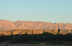 | ||
San manuel arizona my little town
San Manuel is a census-designated place (CDP) in Pinal County, Arizona, United States. The population was 3,551 at the 2010 census.
Contents
- San manuel arizona my little town
- Map of San Manuel AZ USA
- Big ass wash san manuel arizona riding aboard the 2015 ktm 300 xc w 6 days edition
- Geography
- Demographics
- References
Map of San Manuel, AZ, USA
San Manuel was built in 1953 as a company town to serve the then-new San Manuel copper mine, mill and smelter complex. When copper prices fell in the late 1990s, Broken Hill Proprietary (BHP), the owner of the mine and smelter complex shuttered both operations in June 1999. The closing saw 2,500 people lose their jobs. The mine and smelter were permanently closed in 2003.
Nearby towns are Oracle and Mammoth. Both are within ten miles (16 km) of San Manuel and make up the tri-community area.
Big ass wash san manuel arizona riding aboard the 2015 ktm 300 xc w 6 days edition
Geography
San Manuel is located at 32°36′18″N 110°38′0″W (32.605048, -110.633340), in the San Pedro River Valley at an elevation of about 3,500 feet (1,100 m). San Manuel is about 45 miles (72 km) northeast of Tucson.
According to the United States Census Bureau, the CDP has a total area of 20.9 square miles (54.1 km²), all of it land.
Demographics
As of the census of 2000, there were 4,375 people, 1,458 households, and 1,204 families residing in the CDP. The population density was 209.5 people per square mile (80.9/km²). There were 1,832 housing units at an average density of 87.7 per square mile (33.9/km²). The racial makeup of the CDP was 69.05% White, 0.39% Black or African American, 1.37% Native American, 0.34% Asian, 0.07% Pacific Islander, 24.78% from other races, and 4.00% from two or more races. 46.22% of the population were Hispanic or Latino of any race.
There were 1,458 households out of which 43.1% had children under the age of 18 living with them, 66.3% were married couples living together, 10.6% had a female householder with no husband present, and 17.4% were non-families. 15.0% of all households were made up of individuals and 6.7% had someone living alone who was 65 years of age or older. The average household size was 3.00 and the average family size was 3.31.
In the CDP, the population was spread out with 32.6% under the age of 18, 8.8% from 18 to 24, 27.0% from 25 to 44, 21.1% from 45 to 64, and 10.5% who were 65 years of age or older. The median age was 32 years. For every 100 females there were 102.5 males. For every 100 females age 18 and over, there were 98.1 males.
The median income for a household in the CDP was $40,019, and the median income for a family was $42,563. Males had a median income of $36,463 versus $21,304 for females. The per capita income for the CDP was $16,534. About 10.3% of families and 12.8% of the population were below the poverty line, including 18.4% of those under age 18 and 5.6% of those age 65 or over.