
Barangays ZIP code 4210 Local time Tuesday 8:51 AM | District 2nd District Time zone PST (UTC+8) Area 42.56 km² | |
 | ||
Weather 26°C, Wind NE at 8 km/h, 72% Humidity | ||
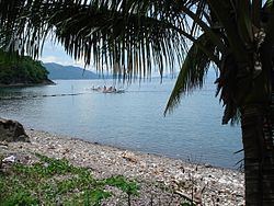
San luis batangas june 2009
San Luis, officially the Municipality of San Luis (Filipino: Bayan ng San Luis), is a municipality in the province of Batangas in the Calabarzon (Region IV-A) of the Philippines. The population was 33,149 at the 2015 census. In the 2016 electoral roll, it had 22,091 registered voters.
Contents
- San luis batangas june 2009
- Map of San Luis Batangas Philippines
- Geography
- Barangays
- Demographics
- References
Map of San Luis, Batangas, Philippines
Geography
San Luis is located at 13°50′N 120°56′E.
According to the Philippine Statistics Authority, the municipality has a land area of 42.56 square kilometres (16.43 sq mi) constituting 7000136000000000000♠1.36% of the 3,119.75-square-kilometre- (1,204.54 sq mi) total area of Batangas.
Barangays
San Luis is politically subdivided into 26 barangays.
Demographics
In the 2015 census, San Luis had a population of 33,149. The population density was 780 inhabitants per square kilometre (2,000/sq mi).
In the 2016 electoral roll, it had 22,091 registered voters.