
Country United States Demonym(s) Sanlorenceños Founded 1811 Zip code 00754 Mayor José Román Abreu (PPD) | Territory Puerto Rico Time zone AST (UTC-4) Area 138 km² Population 40,947 (2011) | |
 | ||
Founded by Valenciano Munoz de Oneca Neighborhoods Roosevelt, Santa Clara | ||
San Lorenzo ([san loˈɾenso], Saint Lawrence) is a municipality of Puerto Rico located in the eastern central region, north of Patillas and Yabucoa; south of Gurabo; east of Caguas and Cayey; and west of Juncos and Las Piedras. San Lorenzo is spread over twelve wards and San Lorenzo Pueblo (The downtown area and the administrative center of the city). It is part of the San Juan-Caguas-Guaynabo Metropolitan Statistical Area.
Contents
- Map of San Lorenzo 00754 Puerto Rico
- History
- Geography
- Economy
- Culture
- Government
- Flag
- Notable natives and residents
- References
Map of San Lorenzo, 00754, Puerto Rico
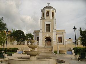
San Lorenzo is called El Pueblo de los Samaritanos or La Tierra de Leyendas. The patron of the municipality is Nuestra Senora de las Mercedes. The surrounding areas produce tobacco and sugar cane.
History
San Lorenzo was founded in 1737 and the church was erected in 1811, the original name San Miguel de Hato Grande was changed to San Lorenzo. According to tradition it was because the latter saint appeared to several neighbors in the river valley. San Lorenzo is known as "The People of the Samaritans" because of the following story; "By 1920, in the barrio Hato of San Lorenzo according to the media available at the time and verbal testimonies of people who are still alive, crowds of people climbed a mountain where a young girl of 12 years of age lived. This young girl named Julia Vazquez Torres, according to some sources, had a supernatural power that repeatedly gave healing to people in need. These undeniable achievements were not present at the time, she used home remedies applied with medicinal plants and minerals and the purity of the water from a well, near the mountain where people came to see her. As time passed, she became an adult, but her reputation for integrity and dedication to the wellbeing of the people accompanied her every day her life".
Geography
San Lorenzo is located in the eastern central region, north of Patillas and Yabucoa; south of Gurabo; east of Caguas and Cayey; and west of Juncos and Las Piedras.
Economy
The economy of San Lorenzo, founded in the herd, that is, livestock farming, later included the cultivation of sugar cane, which was processed in this period in a steam-driven farm and five oxen and two stills . Coffee and fruits are also cultivated in the municipality. Timber production, which was very rich, had declined by the uncontrolled exploitation of forests.
Clothing, pharmaceuticals, footwear, electromechanical equipment, industrial and household paints
Culture
Events and Festivals:
Sports:
Government
Like all municipalities in Puerto Rico, San Lorenzo is administered by a mayor. The current mayor is José Román Abreu(Joe), from the Popular Democratic Party (PPD). Román was elected at the 2000 general election.
The city belongs to the Puerto Rico Senatorial district VII, which is represented by two Senators. In 2012, Jorge Suárez and José Luis Dalmau were elected as District Senators.
Flag
The flag of San Lorenzo is divided in four rectangles of equal size, two rectangles are yellow and the other two are striped with red and yellow stripes.
Coat of arms The grill is the traditional symbol of San Lorenzo, deacon and martyr, patron of the town, because in a grill he underwent the martyrdom, slowly burned to death. The hill or mountain represent the Gregorio Hill, which dominates the San Lorenzo panorama. The cross is one of the heraldic attributes of San Miguel Arcángel.