
Barangays ZIP code 3102 Population 58,120 (2010) | District 4th District Time zone PST (UTC+8) Area 151.9 km² Local time Tuesday 8:11 AM Dialling code 44 | |
 | ||
Weather 25°C, Wind W at 2 km/h, 68% Humidity Neighborhoods Mambangnan, Tabuating, Nieves, Diversion, Castellano, San Anton | ||
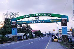
San Leonardo is a first class municipality in the province of Nueva Ecija, Philippines. According to the 2010 census, it has a population of 58,120 people.
Contents
- Map of San Leonardo Nueva Ecija Philippines
- Barangays
- History
- Public elementary schools
- Public high schools
- Tertiary
- Private schools
- References
Map of San Leonardo, Nueva Ecija, Philippines
San Leonardo is located between Gapan City and Santa Rosa. It is 103 kilometres (64 mi) from Manila. The area has a farming economy. San Leonardo has vast rice fields and land for growing vegetables and poultry products.
Barangays
San Leonardo is politically subdivided into 15 barangays.
History
During World War II, Japanese Occupation forces entered in San Leonardo, Nueva Ecija on 1942 during the Japanese Invasion and Occupation. Novo Ecijano and Hukbalahap Communist guerrilla resistance groups from 1942 to 1944 in San Leonardo, Nueva Ecija for the sieges and invasions to attacked of the Japanese Imperial forces was found retreated and before the liberation on 1945 from the Allied troops.
On January to April 1945, the joint and combined military force of Filipino soldiers and officers under the Philippine Commonwealth Army and Philippine Constabulary units and the American soldiers and officers under the United States Army units was recaptured and they liberated the town municipality of San Leonardo, Nueva Ecija and they helping to the Novo Ecijano and Hukbalahap Communist resistance groups and defeats against the Japanese soldiers and officers under the Imperial Japanese Armed Forces and the Makapili soldiers and begins the Battle of San Leonardo and the Battle of Gapan between the Japanese and the combined American and Philippine Commonwealth troops on January to April 1945 and ended World War II.