
Country Chile Commune Juan Fernández Elevation 0 m (0 ft) Number of airports 1 | Founded 1877 | |
 | ||
Time zone Chilean Standard (UTC-4) Weather 19°C, Wind SE at 34 km/h, 69% Humidity | ||
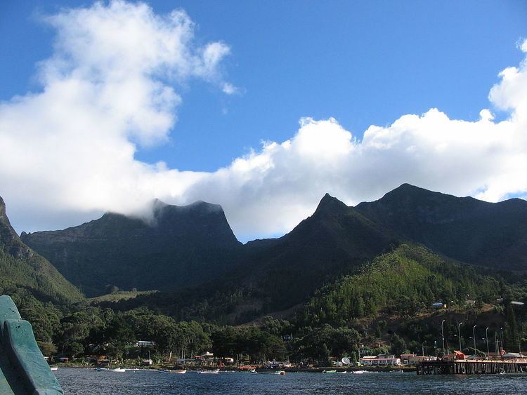
San Juan Bautista is the main town in the Juan Fernández Islands. Some sources say it was founded in 1877, while others give an earlier date of 1750. It is located on Cumberland Bay on the center of the northeast coast of Robinson Crusoe Island.
Contents
Although the community maintains a rustic serenity dependent on the spiny lobster trade, residents employ a few vehicles, a satellite internet connection, and many television sets. As of the 2012 census, the town had a population of 800 in an area of 0.31 km2 (0.12 sq mi).
There is a soccer pitch at the northern end of the village. The nearby school is called the Dresden School, after the German light cruiser SMS Dresden which was sunk here during World War I, as is the street it is situated on. The names of other generally unpaved streets in the village include Larraín Alcalde, Ignacio Carrera Pinto, El Sándalo, Vicente González, Teniente Cortés, and La Pólvora.
Overlooking San Juan Bautista are Las Cuevas de los Patriotas (Patriots' Caves), where 42 Chilean creole independence activists lived during their exile by the Spanish authorities after the Battle of Rancagua in 1814. The exiles included prominent figures such as Juan Egaña and Manuel de Salas.
Transportation
As of early 2010, a pair of ships operated by the Chilean Navy arrive each month from mainland Chile. The number of passengers is limited, so arrangements must be made as much as a month in advance. The navy gives preference to locals. One-way trip time is 24 – 36 hours or more depending on sea conditions.
There is a short, 885 m (2,904 ft) airstrip (ICAO airport code: SCIR) in the southwestern end of the Robinson Crusoe Island, the only reasonably flat part of the island. Operations are mostly in twin-engine, seven-seat light planes, with very limited baggage capabilities. The flight time from the mainland of Chile is about 2 hours 30 minutes, plus a 1-hour 30 minute boat ferry to the village at the opposite side of the island.
Climate
San Juan Bautista has a very mild Mediterranean climate (Köppen Csb), with rainfall intermediate between that of Valparaíso and Concepción. Temperature is influenced by the cold Humboldt Current, which flows northward to the east of Robinson Crusoe Island, and the southeast trade winds.
2010 tsunami
On February 27, 2010, at least eight people lost their lives when a tsunami caused by the Chilean 8.8 earthquake hit the island and inundated the town. Most of the buildings in the community were destroyed. The disaster could have been worse if not for a timely warning from a 12-year-old girl named Martina Maturana which saved many of her neighbors from harm.