
Elevation 122 m Local time Monday 2:53 PM | Population 667 (2010) | |
 | ||
Weather 32°C, Wind SW at 24 km/h, 21% Humidity | ||
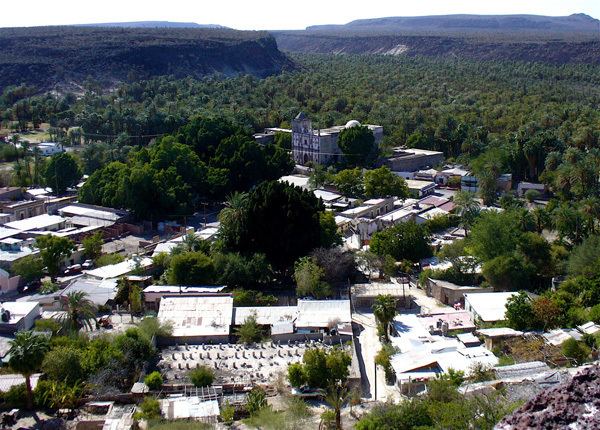
San Ignacio is a palm oasis town in Mulegé Municipality of northern Baja California Sur state in Mexico.
Contents
Map of San Ignacio, Baja California Sur, Mexico
It is located on Mexican Federal Highway 1 between Guerrero Negro and Santa Rosalía.
The town had a 2010 census population of 667 inhabitants and grew at the site of the Cochimí settlement of Kadakaamán and the Jesuit Mission San Ignacio founded in 1728 by Juan Bautista Luyando.
Natural history
The locale has certain basaltic soils, providing clues as to the volcanic history of this region. There are a variety of desert flora and fauna in the vicinity of San Ignacio, notably including the Elephant tree, (Bursera microphylla).
At San Ignacio, Baja California's arid Central Desert terrain gives way to a large grove of lush green date palms. A large spring-fed pond and small river on the outskirts of town feeds into the central plaza and village next to the eighteenth-century Jesuit mission. San Ignacio serves as the gateway to San Ignacio Lagoon, the winter time sanctuary of the Pacific Gray Whale.
Location
San Ignacio is located approximately 866 km/567 miles from the San Diego, California|/Tijuana border crossing, about a 10- to 12-hour drive. One can travel on Mexican Federal Highway 1 by vehicle to arrive in San Ignacio. Highway 1 is a well-maintained, four-lane, toll highway from Tijuana to Ensenada. South of Ensenada, Highway 1 becomes a narrow (but relatively well-maintained) two-lane highway. Slow but steady progress is being made to support the tourism industry and Pemex gas stations are now located in every major town through which Highway 1 travels on the way to San Ignacio, both from the North and from the South. Driving only during daylight hours is recommended, due to livestock that frequently cross the road at night, and decreased visibility of the narrow and winding roads through the mountain sides.
The nearest airports are located to the north at Guerrero Negro Airport in Guerrero Negro, or to the south at Loreto International Airport in Loreto.