
FIPS code 37-58740 Area 11.1 km² Zip code 28655 Area code 828 | Time zone Eastern (EST) (UTC-5) GNIS feature ID 0994153 Elevation 370 m Population 2,218 (2010) | |
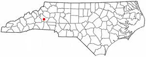 | ||
Salem is a census-designated place (CDP) in Burke County, North Carolina, United States. The population was 2,218 at the 2010 census. It is part of the Hickory–Lenoir–Morganton Metropolitan Statistical Area.
Contents
Map of Salem, NC 28655, USA
History
Gilboa Methodist Church was listed on the National Register of Historic Places in 1984.
Geography
Salem is located in central Burke County at 35°42′14″N 81°41′56″W (35.703920, -81.698820). It is bordered to the north by the city of Morganton, the county seat.
U.S. Route 64 (Burkemont Avenue) is the main road through the community, leading north into Morganton and southwest 29 miles (47 km) to Rutherfordton. Interstate 40 passes along the northern edge of the CDP, with access from Exit 103 (US-64).
According to the United States Census Bureau, the CDP has a total area of 4.3 square miles (11.1 km2), all land.
Demographics
As of the census of 2010, there were 2,218 people, 1,036 households, and 678 families residing in the CDP. The population density was 692.3 people per square mile (267.4/km²). There were 1,032 housing units at an average density of 227.9 per square mile (88.0/km²). The racial makeup of the CDP was 78.86% White, 15.91% African American, 0.48% Native American, 1.81% Asian, 0.44% Pacific Islander, 1.27% from other races, and 1.23% from two or more races. Hispanic or Latino of any race were 2.19% of the population.
There were 998 households out of which 29.5% had children under the age of 18 living with them, 56.6% were married couples living together, 11.0% had a female householder with no husband present, and 26.1% were non-families. 22.8% of all households were made up of individuals and 8.0% had someone living alone who was 65 years of age or older. The average household size was 2.45 and the average family size was 2.82.
In the CDP, the population was spread out with 25.0% under the age of 18, 21.8% from 18 to 24, 21.2% from 25 to 44, 21.5% from 45 to 64, and 10.5% who were 65 years of age or older. The median age was 28 years. For every 100 females there were 153.1 males. For every 100 females age 18 and over, there were 147.5 males.
The median income for a household in the CDP was $32,050, and the median income for a family was $45,430. Males had a median income of $28,672 versus $21,913 for females. The per capita income for the CDP was $14,506. About 9.5% of families and 10.7% of the population were below the poverty line, including 11.6% of those under age 18 and 17.7% of those age 65 or over.