
Length 75 km Source elevation 2,500 m | Basin size 1,570 km (610 sq mi) Discharge 43 m³/s | |
 | ||
Main source Mont Rouch, Pyrenees2,500 m (8,200 ft) Progression Garonne→ Atlantic Ocean | ||
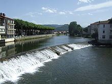
The Salat (Occitan: Salat) is a river in southern France, a right tributary of the Garonne. It rises in nine points above the hamlet Salau in the municipality Couflens, on the slopes of Mont Rouch, central Pyrenees. The former Gascon province of Couserans is based on its valley.
Contents
Map of Le Salat, France
Departments and Cities
Main tributaries
References
Salat (river) Wikipedia(Text) CC BY-SA