Population (1999) 1,311 Area 25.34 km² Arrondissement Segré | Canton Segré Time zone CET (UTC+1) Local time Wednesday 4:48 AM | |
 | ||
Weather 7°C, Wind S at 6 km/h, 87% Humidity | ||
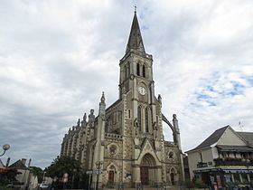
Sainte-Gemmes-d'Andigné is a former commune in the Maine-et-Loire department in western France. On 15 December 2016, it was merged into the new commune Segré-en-Anjou Bleu.
Contents
Map of 49500 Sainte-Gemmes-d'Andign%C3%A9, France
Geography
The Oudon River forms part of the commune's north-eastern border. The village lies on the right bank of the Verzée, which flows east-northeastward through the commune.
References
Sainte-Gemmes-d'Andigné Wikipedia(Text) CC BY-SA
