
Time zone CET (UTC+1) Area 39.04 km² | INSEE/Postal code 18234 /18370 Population 466 (1999) | |
 | ||
Saint-Saturnin is a commune in the Cher department in the Centre region of France.
Contents
Map of 18370 Saint-Saturnin, France
Geography
An area of streams, forestry and farming comprising the village and several hamlets situated by the banks of the small river Cotet, about 44 miles (71 km) south of Bourges at the junction of the D3 with the D111 and the D162 roads. The commune shares a border with the department of Indre.
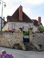
Sights
References
Saint-Saturnin, Cher Wikipedia(Text) CC BY-SA