
Country Canada RCM Matawinie Constituted March 3, 1979 Area 568 km² Province Québec | Region Lanaudière Settled 1863 Time zone EST (UTC−5) Population 2,436 (2011) | |
 | ||
Saint-Michel-des-Saints is a municipality in the Matawinie Regional County Municipality of Quebec, Canada. During its history, agriculture, forestry, recreation and tourism were the main purposes of the region.
Contents
- Map of Saint Michel des Saints QC Canada
- History
- Geography
- Population
- Language
- Cultural twinning
- References
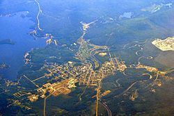
Map of Saint-Michel-des-Saints, QC, Canada
History
In 1863, Thomas-Léandre Brassard settled near the falls of Pine Lake (Lac des Pins) where he built a mill and a manor. Three years later, there were 136 inhabitants. In 1870, the post office opened. By 1883, the Parish of Saint-Michel-des-Saints was officially formed and followed two years later in 1885 by the formation of the parish municipality. The name Saint-Michel-des-Saints, chosen by Ignace Bourget at the suggestion of Father Brassard, honours Michael de Sanctis who lived from 1591 to 1625.
In 1929, the dam on the Matawin River was constructed that would result in the formation of the Taureau Reservoir. This reservoir drowned the neighbouring village of Saint-Ignace-du-Lac (founded in 1877) and consequently this municipality was annexed by Saint-Michel-des-Saints in 1931, thereby increasing its territory by about 15 square kilometres (5.8 sq mi).
In 1979, the Parish Municipality of Saint-Michel-des-Saints and the United Township Municipality of Masson-et-Laviolette (founded in 1914) were merged to form the new Municipality of Saint-Michel-des-Saints.
Geography
Saint-Michel-des-Saints is the largest and northern-most municipality in the Lanaudière region (not considering the unorganized territories). The village itself is located at the northern end of Quebec Route 131 along the Matawin River, near the south-western corner of Taureau Reservoir.
The larger lakes in the municipality include Durand, Beauséjour, Hazen, and Kaiagamac. These and the many other ones attract many summer cottage vacationers. The area's forests are popular for hunting and trapping.
Population
In the 2011 Census, Statistics Canada originally reported that Saint-Michel-des-Saints had a population of 2,201 living in 979 of its 1,774 total dwellings, an 18.9% change from its 2006 population of 2,713. Statistics Canada subsequently amended the 2011 census results to a population of 2,436 living in 1,084 of its 1,990 total dwellings, a -10.2% change from 2006. With a land area of 501.28 km2 (193.55 sq mi), it had a population density of 4.8596/km2 (12.5862/sq mi) in 2011.
Language
Mother tongue:
Cultural twinning
Saint-Michel-des-Saints is twinned with the community of Saint-Varent in the Deux-Sèvres department in western France.