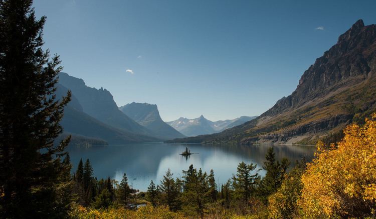
Type Natural Max. length 9.9 mi (15.9 km) Max. depth 300 ft (91 m) Area 15.88 km² Outflow location St. Mary River | Basin countries United States Surface area 3,923 acres (15.88 km) Surface elevation 1,367 m Length 11.3 km | |
 | ||
Primary outflows St. Mary River (Alberta–Montana) | ||
Saint Mary Lake is the second-largest lake in Glacier National Park, in the U.S. state of Montana.
Map of Saint Mary Lake, Montana 59417, USA
Located on the east side of the park, the Going-to-the-Sun Road parallels the lake along its north shore. At an altitude of 4,484 feet (1,367 m), Saint Mary Lake's waters are colder and lie almost 1,500 feet (460 m) higher in altitude than Lake McDonald, the largest lake in the park, which is located on the west side of the Continental Divide. Here, the great plains end and the Rocky Mountains begin in an abrupt 5,000-foot (1,500 m) altitude change, with Little Chief Mountain posing a formidable southern flank above the west end of the lake.
The lake is 9.9 miles (15.9 km) long and 300 feet (91 m) deep with a surface area of 3,923 acres (15.88 km2). The waters of the lake rarely rise above 50 °F (10 °C) and are home to various species of trout. During the winter, the lake is often completely frozen over with ice up to 4 feet (1.2 m) thick.
The opening scene in the 1980 Stanley Kubrick film The Shining was shot at Saint Mary Lake.
