
Time zone CET (UTC+1) Population 1,248 (1999) | Canton Le Touvet Area 8.61 km² Local time Tuesday 8:51 PM | |
 | ||
Intercommunality Plateau des petites roches Weather 12°C, Wind N at 6 km/h, 49% Humidity Points of interest Dent de Crolles, Station de Ski de Saint Hila, Réserve naturelle nationale | ||
Saint-Hilaire (also known as Saint-Hilaire du Touvet) is a commune in the Isère department in southeastern France.
Map of 38660 Saint-Hilaire, France
It is made up of the three smaller settlements of Saint-Hilaire, Les Margains and Les Gaudes, and its inhabitants are called the Saint-Hilairois (Saint-Hilairoises).
The commune is situated on the Plateau des Petites Roches, a natural balcony above the valley of the Isère River, on the east side of the Massif de la Chartreuse and overlooked by the peak of the Dent de Crolles.
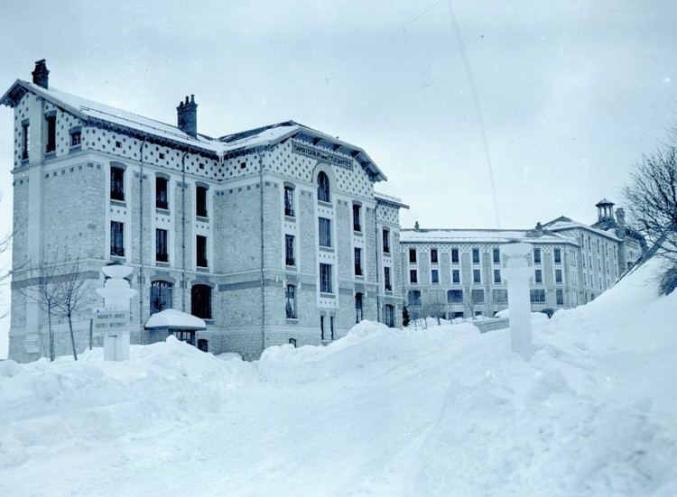
Saint-Hilaire is linked to Montfort, situated on the road between Grenoble and Chambéry in the valley below, by the Funiculaire de Saint-Hilaire du Touvet. Until this was opened in 1924, the village was accessible only on foot, or by mule. The funicular was constructed principally to serve several sanatoriums built at the same time to house tuberculosis patients.