
Country France Department Allier Canton Lapalisse Area 28.02 km² Population 481 (1999) | Region Auvergne-Rhône-Alpes Arrondissement Vichy Intercommunality Pays de Lapalisse Local time Tuesday 6:09 PM | |
 | ||
Weather 17°C, Wind N at 8 km/h, 48% Humidity | ||
Saint-Christophe is a commune in the Allier department in Auvergne-Rhône-Alpes in central France.
Contents
Map of 03120 Saint-Christophe, France
Geography
Saint-Christophe is surrounded by the communes of Billezois, Saint-Prix, Le Breuil, Isserpent, Molles, and Saint-Étienne-de-Vicq. Saint-Christophe lies about 16 kilometres (9.9 mi) from Vichy.
The south of the commune is rolling hills and valleys, whereas the north is flatter and more favorable to agriculture. Le Mourgon, the principal stream of the commune is 18 km long and separates these two parts.
Population
The population of the commune peaked in the 1890s and has since returned to the level of the 17th century.
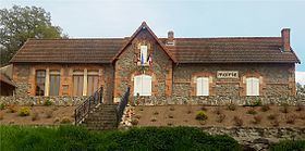
Sights
References
Saint-Christophe, Allier Wikipedia(Text) CC BY-SA