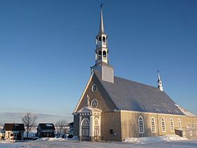
Country Canada RCM Kamouraska Time zone EST (UTC−5) Area 70.6 km² Local time Tuesday 10:46 AM | Region Bas-Saint-Laurent Constituted February 14, 1987 Postal code(s) G0L 2H0 Population 651 (2011) Province Québec | |
 | ||
Weather -1°C, Wind E at 6 km/h, 90% Humidity | ||
Saint-André is a municipality in the Canadian province of Quebec, located in the Kamouraska Regional County Municipality.
Contents
Map of Saint-Andr%C3%A9, QC, Canada
Geography
Saint-André is located on the southern shoreline of the Saint Lawrence River along with several islands belonging to the municipality situated offshore to the north.
Communities
The following locations reside within the municipality's boundaries:
Lakes and rivers
The following waterways pass through or are situated within the municipality's boundaries:
Municipal council
References
Saint-André, Quebec Wikipedia(Text) CC BY-SA
