
Country Canada Settled 1860s Time zone EST (UTC−5) Area 59.2 km² Local time Tuesday 9:52 PM Area code 819 | Region Outaouais Constituted January 1, 1881 Postal code(s) J0T 1K0, J0V 1Y0 Population 566 (2011) Province Québec RCM Outaouais | |
 | ||
Weather 2°C, Wind N at 8 km/h, 88% Humidity | ||
Saint-Émile-de-Suffolk is a municipality in the Outaouais region of Quebec, Canada, part of the Papineau Regional County Municipality. Until 1994 it was known as United Township Municipality of Suffolk-et-Addington.
Contents
Map of Saint-%C3%89mile-de-Suffolk, QC, Canada
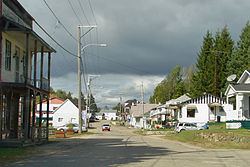
This farming community, 40 kilometers (25 mi) north of Montebello, is often visited by cottage vacationers for hunting and fishing in the numerous lakes of the area.
Geography
The area is characterized by rugged terrain of the Laurentian Mountains, marked here and there by mountains that rise more than 400 meters (1,300 ft) above sea level. Its principal streams are the Little Rouge River and the Suffolk Creek that feeds it, the first being a tributary of the Petite-Nation River.
History
Suffolk Township (named after the county in England) was already on the Gale and Duberger map of 1795, but not officially established until 1874. Municipally it was part of the United Township Municipality of Hartwell-et-Suffolk until 1880 when the municipality separated and the Township Municipality of Suffolk was formed, taking effect on January 1, 1881.
In 1885, Addington Township (named after Henry Addington, 1st Viscount Sidmouth) was merged with Suffolk Township, creating the United Township Municipality of Suffolk-et-Addington.
In 1889, the Parish of Saint-Émile-de-Suffolk was formed. This name paid tribute to Émile Quesnel of Saint-Andre-Avellin, who had been particularly generous toward the early settlers of the area.
Piece by piece, portions of the united township were detached to form new municipalities: Vinoy in 1920 (which became part of Chénéville in 1996), Lac-des-Plages in 1950, and finally Namur in 1964.
In 1994, the name and status were changed to that of Municipality of Saint-Émile-de-Suffolk.
Demographics
Population trend:
Private dwellings occupied by usual residents: 247 (total dwellings: 410)
Mother tongue: