
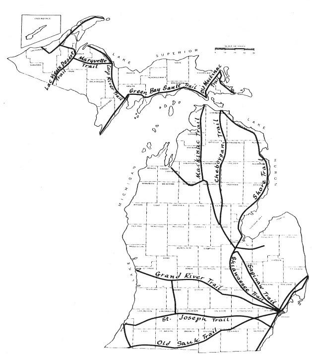
 | ||
Saginaw Trail is the collective name for a set of connected roads in Southeastern Michigan that runs from Detroit to Saginaw through Pontiac and Flint. It was originally a tribal foot trail. On December 7, 1818, the Michigan Territorial government authorized the building of a road from Detroit to Saginaw along the trail. In the early 20th century, it was used as part of the Dixie Highway and the Theodore Roosevelt International Highway, early auto trails in the state. It was later designated as a part of US Highway 10 (US 10) when the United States Numbered Highway System was created in 1926. Since the Michigan portion of Interstate 75 (I-75) was completed in 1973, it has been a county road or part of other state highways.
To drive it today, drivers would follow:
Bus. US 24 (Woodward Avenue) into downtown Pontiac;