
Country United States Local time Monday 8:01 AM Municipality Ponce | Territory Puerto Rico Population 6,420 (2000) | |
 | ||
Weather 24°C, Wind N at 2 km/h, 87% Humidity Area 7.226 km² (7.071 km² Land / 16 ha Water) University Ponce Paramedical College Inc | ||
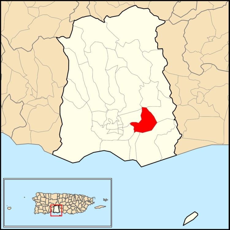
Sabanetas (Barrio Sabanetas) is one of the 31 barrios of the municipality of Ponce, Puerto Rico. Along with Magueyes, Tibes, Portugués, Montes Llanos, Machuelo Arriba, Maragüez, and Cerrillos, Sabanetas is one of the municipality's eight rural interior barrios. The name of this barrio is of native Indian origin. It was founded in 1831.
Contents
Map of Sabanetas, Ponce, Puerto Rico
Location
Sabanetas is located in the southern section of the municipality, east of the traditional city center at Plaza Las Delicias. The toponomy, or origin of the name, is one that describes an open valley covered by grasslands and few, if any, trees.
Boundaries
It is bounded on the North by barrio Cerrillos, in the South by barrios Bucaná and Vayas, in the West by barrios Machuelo Abajo and San Anton, and in the East by barrios Coto Laurel and Vayas.
Features and demographics
Sabanetas has 2.7 square miles (7.0 km2) of land area and 0.1 square miles (260,000 m2) of water area. In 2000, the population of Sabanetas was 6,420. The population density in Sabanetas was 2,352 persons per square mile.
The communities of Campo Alegre, Alta Vista, Villa Flores, and Sabanetas proper are located in barrio Sabanetas.
Major roads serving Barrio Sabanetas are PR-1, PR-52, and PR-10.
The highest point in Barrio Sabanetas is Cerro Los Negrones which stands at 397 feet.
Landmarks
The Sabanetas Industrial Park is located in Sabanetas, as is Central Mercedita.