
Founded 1903 Demonym(s) Sabaneteño Local time Monday 7:01 AM | Elevation 1,550 m (5,090 ft) Area 15 km² Population 43,357 (2012) | |
 | ||
Weather 17°C, Wind NE at 3 km/h, 87% Humidity Points of interest Sabaneta Park, BROADWAY casino, bonaforte casino | ||
Sabaneta is a municipality of Colombia, located in the Aburrá Valley of the Antioquia department. It is boarded on the North by the municipalities of La Estrella, Itagüí and Envigado, on the East by the municipality of Envigado, on the South by the municipality of Caldas, and on the West by the municipality of La Estrella.
Contents
Map of Sabaneta, Antioquia, Colombia
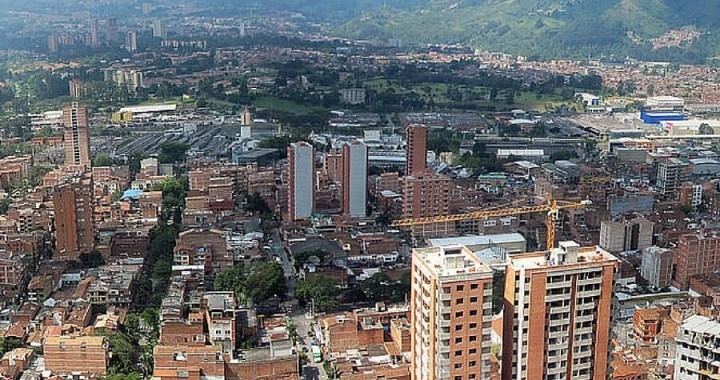
It is the smallest municipality in Colombia, with only 15 km². It is known as the Municipio Modelo de Colombia (Model Municipality of Colombia) or the Vallecito de Encanto (Charming little Valley). The municipality owes its name to the diminutive “sabana,” a Spanish word meaning “savannah”. The population receives an influx of visitors on the weekends because of its reputation for having outstanding entertainment venues.
History
Sabaneta was initially inhabited by the Anacona indigenous peoples (aboriginals from the other side of the Aná), who settled the eastern slope, starting from the hill of Pan de Azucar. In the year 1750, Spanish families settled in this place. The Montoya, Restrepo, Vélez, Díaz, Díez, Vásquez, Guzmán, Garcés, Baena, Salazar, Mejía, Mesas, Álvarez and Soto families were the second group to populate this region.
Geography
Sabaneta, which sits at the south end of the Aburrá Valley, is part of the process of conurbation of the Medellín Metropolitan Area, being located 14 kilometers from the center of the city of Medellín. The municipality has an area of 15 km², of which 67% of the territory is urban.
Its topography varies from flat reliefs and slight hills to places with steep slopes. Its most notable heights are those of Piedras Blancas (2,650 mamsl) in La Romera, the Cuchilla Santa Teresa (2,200 mamsl), the hill of Los Gallinazos in Pan de Azúcar (1,800 mamsl), the hill Morrón, La Siberia and the Ancón.
The main stream is the Medellín River, which serves as its border with the municipality Itagüí. The most important tributary of this river, in the municipality, is the La Doctora gorge, along with the streams Buenavista, La Escuela, El Gusano, El Canalón, La Honda, La Sabanetica and La Cien Pesos, which mark its borders with Envigado.
Political-Administrative Structure
The Municipality of Sabaneta is governed by a democratic system based in the processes of administrative decentralization generated from the proclamation of the Political Constitution of Colombia of 1991. The city is governed by a mayor (executive power) and a Municipal Council (legislative power). The Mayor of Sabaneta is the head of the government and of the municipal administration, legally, judicially and extrajudicially representing the municipality. It is a position, currently held by Luz Estela Giraldo, which is elected by a popular vote and held for a period of four years. Its main functions include management of the resources of the municipality, ensurance of the welfare and interests of its citizens and representation of its citizens before the National Government. In addition, the Mayor must promote local policies that improve quality of life, with health, housing, education and infrastructure programs, and maintain public order. The Municipal Council of Sabaneta is a public corporation of popular election, composed of 13 elected representatives of different political leanings, elected democratically for a period of four years. The council is a legislative entity of the municipality which issues mandatory agreements in its territorial jurisdiction. Among its functions are approving the Mayor's projects, dictating the natural rules of the budget and issuing the annual budget of incomes and expenditures. Administratively, the government of Sabaneta divides into to big groups: the central administration and the decentralized entities. The Central Administration is the set of entities that report directly on the Mayor. These entities are known as secretariats. The secretariats are administrative units whose main objective is the provision of services to the community or to the Central Administration. The local government has 7 secretariats and 5 decentralized entities.