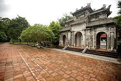
Country Vietnam Area 113.5 km² Population 181,831 (Mar 2008) | Province Hanoi Local time Tuesday 11:36 PM University Tran Quoc Tuan University | |
 | ||
Weather 22°C, Wind SE at 13 km/h, 92% Humidity Points of interest Duong Lam Ancient V, Thành Cổ Sơn Tây, Chùa Mía, Dong Mo, Khmer Temple | ||
Sơn Tây ( listen) is a provincial town in Hanoi, the capital of Vietnam. It was the capital of Son Tay province before merging with Ha Dong province in 1965. Son Tay lies 35 km west of the capital Hanoi and is often referred to as “soldier town” due to the proliferation of army barracks and military institutions that surrounds the town, including the Vietnamese People's Army Infantry Academy.
Contents
Map of Tx. S%C6%A1n T%C3%A2y, Hanoi, Vietnam
Sơn Tây's future is seen as being very much that of a satellite city of Hanoi and as a result there are plans to relocate universities and other public facilities to Son Tay where land is cheaper and more plentiful. The government have commenced this ambitious program by duplicating the main Hanoi—Sơn Tây carriageway which was expected to be completed in 2009.
History
Sơn Tây is known for its thousand year old villages, such as Duong Lam which retains a collection of vernacular architecture with buildings and temples built using laterite bricks. Và Temple, or Đông Cung, dedicated to Tản Viên is located on a hill covered with ironwood trees in Vân Giã hamlet, Trung Hưng commune, Sơn Tây town. Pham Van Son, a general was from Son Tay.
