Country Canada Census Division No. 19 Highways 249 Elevation 600 m Province Alberta | Time zone MST (UTC-7) Area 169 ha Population 612 (2016) Local time Saturday 7:12 AM | |
 | ||
Weather -5°C, Wind SW at 6 km/h, 97% Humidity | ||
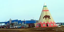
Rycroft is a village in northern Alberta, Canada. It is located 68 km north of the city of Grande Prairie and 7 km east of Spirit River. Dunvegan Provincial Park is located 20 km north of the community.
Contents
Map of Rycroft, AB, Canada
Demographics
In the 2016 Census of Population conducted by Statistics Canada, the Village of Rycroft recorded a population of 612 living in 274 of its 316 total private dwellings, a 2999750000000000000♠−2.5% change from its 2011 population of 628. With a land area of 1.92 km2 (0.74 sq mi), it had a population density of 318.8/km2 (825.6/sq mi) in 2016.
In the 2011 Census, the Village of Rycroft had a population of 628 living in 280 of its 310 total dwellings, a -1.6% change from its 2006 population of 638. With a land area of 1.69 km2 (0.65 sq mi), it had a population density of 371.6/km2 (962.4/sq mi) in 2011.
According to the 2006 census, Rycroft had a:
