
Population Uninhabited Area 940 km² | Highest elevation 240 m (790 ft) Elevation 240 m | |
 | ||
Island group Canadian Arctic Archipelago | ||
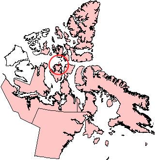
Russell Island is an uninhabited island of the Canadian Arctic Archipelago in the Qikiqtaaluk Region of Nunavut, Canada. It is located in the Parry Channel, separated from the northern tip of Prince of Wales Island by the narrow Baring Channel. The island is longer than it is wide. The western third of the island is separated from the other two thirds by a narrow lake and its outlet. At the northern end of the lake there is an isthmus just 1.1 km (0.68 mi) wide and this joins the two parts of the island. With a total area of 940 km2 (360 sq mi), it is the largest island offshore of Prince of Wales Island.
Map of Russell Island, Baffin, Unorganized, NU, Canada
William Edward Parry was the first European to sight the island in 1819.
Another, much smaller Russell Island lies off the northwest tip of Devon Island. A third one lies in the West Foxe Islands, in Hudson Strait, southwest of Alareak Island.