
Country United States ZIP codes 43150, 43163 Elevation 320 m Local time Friday 9:08 PM Area code 740 | Time zone Eastern (EST) (UTC-5) FIPS code 39-69204 Area 62 ha Population 304 (2013) | |
 | ||
Weather 19°C, Wind S at 10 km/h, 57% Humidity | ||
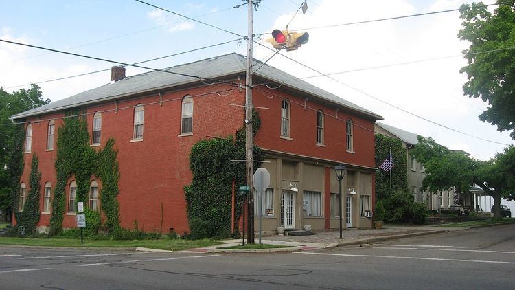
Rushville is a village in Fairfield County, Ohio, United States. The population was 302 at the 2010 census.
Contents
Map of Rushville, OH 43150, USA
Rushville takes its name from nearby Rush Creek.
Geography
Rushville is located at 39°45′54″N 82°25′53″W (39.764882, -82.431393).
According to the United States Census Bureau, the village has a total area of 0.24 square miles (0.62 km2), all land.
2010 census
As of the census of 2010, there were 302 people, 107 households, and 81 families residing in the village. The population density was 1,258.3 inhabitants per square mile (485.8/km2). There were 120 housing units at an average density of 500.0 per square mile (193.1/km2). The racial makeup of the village was 96.0% White, 0.7% Asian, and 3.3% from two or more races.
There were 107 households of which 44.9% had children under the age of 18 living with them, 52.3% were married couples living together, 14.0% had a female householder with no husband present, 9.3% had a male householder with no wife present, and 24.3% were non-families. 16.8% of all households were made up of individuals and 4.7% had someone living alone who was 65 years of age or older. The average household size was 2.82 and the average family size was 3.12.
The median age in the village was 32.3 years. 30.5% of residents were under the age of 18; 9.5% were between the ages of 18 and 24; 31.9% were from 25 to 44; 22.9% were from 45 to 64; and 5.3% were 65 years of age or older. The gender makeup of the village was 47.4% male and 52.6% female.
2000 census
As of the census of 2000, there were 268 people, 90 households, and 74 families residing in the village. The population density was 1,183.4 people per square mile (449.9/km²). There were 103 housing units at an average density of 454.8 per square mile (172.9/km²). The racial makeup of the village was 97.01% White, 0.75% Native American, and 2.24% from two or more races.
There were 90 households out of which 52.2% had children under the age of 18 living with them, 61.1% were married couples living together, 12.2% had a female householder with no husband present, and 16.7% were non-families. 14.4% of all households were made up of individuals and 5.6% had someone living alone who was 65 years of age or older. The average household size was 2.98 and the average family size was 3.25.
In the village, the population was spread out with 34.7% under the age of 18, 8.6% from 18 to 24, 33.6% from 25 to 44, 19.8% from 45 to 64, and 3.4% who were 65 years of age or older. The median age was 31 years. For every 100 females there were 98.5 males. For every 100 females age 18 and over, there were 96.6 males.
The median income for a household in the village was $33,750, and the median income for a family was $45,875. Males had a median income of $31,563 versus $25,417 for females. The per capita income for the village was $13,864. About 12.7% of families and 14.7% of the population were below the poverty line, including 16.5% of those under the age of eighteen and 66.7% of those sixty five or over.