Country Turkey Elevation 30 m (100 ft) Postal code 34450 Province Istanbul Province | District Sarıyer Time zone EET (UTC+2) Licence plate 34 Area code 0212 | |
 | ||
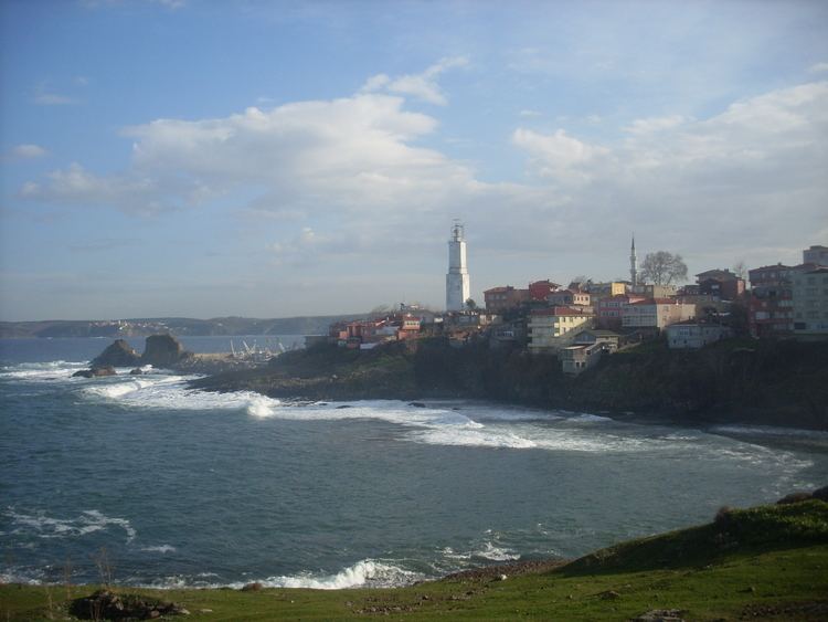
Rumelifeneri (named after the lighthouse Rumeli Feneri) is a village in İstanbul Province, Turkey.
Contents
- Map of Rumelifeneri Rumelifeneri Mahallesi 34450 SarC4B1yer2FC4B0stanbul Turkey
- Geography
- History
- Economy
- References
Map of Rumelifeneri, Rumelifeneri Mahallesi, 34450 Sar%C4%B1yer%2F%C4%B0stanbul, Turkey
Geography
Rumelifeneri is in Sarıyer intracity district of Istanbul Province. At 41°14′N 29°07′E it is a coastal village located at the extreme northwest (i.e., European side) of the Bosphorous Strait. It is a suburb of Istanbul. The distance to Sarıyer is 10 kilometres (6.2 mi) and to the center of Greater Istanbul is about 25 kilometres (16 mi). The population of Rumelifeneri is 2,337 as of 2010.
History
The village is an old settlement. Its name was Panium in the ancient ages, Fanarraki or Fanarayan during the Byzantine Empire. The lighthouse the symbol of the village, was built by the Republic of Genoa which fought against Republic of Venice in 1352 and colonized the area before Turkish conquest in the Middle Ages. The light house was rebuilt in the 19th century by the Ottoman Empire. There are two ruins in the village which are historically important. The Pompeius column was constructed by the Byzantine Empire and the citadel was built by the Ottoman sultan Murat IV in the 17th century. Another important event which Rumelifeneri was involved was the rebellion of Kabakçı Mustafa.
Economy
Rumelifeneri is a fishermen's village. But it is very close to Istanbul, which makes the village a place of seafood restaurants specialized for daily excursion of Istanbul citizens.
