
Location Central Serbia | Elevation 1,132 m | |
 | ||
Similar Bukulja, Kosmaj, Goč, Rajac, Maljen | ||
Rudnik (Serbian Cyrillic: Рудник, [rûːdniːk]) is a mountain in central Serbia, near the town of Gornji Milanovac. Its highest peak Cvijićev vrh, named after geologist and biologist Jovan Cvijić, has an elevation of 1,132 meters above sea level. It has several other peaks over 1000 m: Srednji Šturac, Mali Šturac, Molitve, Paljevine and Marijanac. The name translates literally to mine, as the mountain is rich in mining resources.
Contents
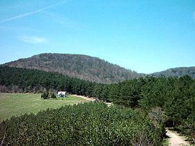
Map of Rudnik, Majdan, Serbia
History
The archaeological site of Belovode on the Rudnik mountain in Serbia contains the world's oldest securely dated evidence of copper smelting at high temperature, from 5,000 BCE.
A thousand years later, a farming population (I haplogroup) from the Taurus Mountains arrived to this location. The first outpost in Europe was in the 6004-5960 B.C. in the pass between the Danube and the Carpathians; before, the dominant haplogroup in Europe was the G, now in Georgia, mainly with R1b together.
Before the arrival of the Romans, the area was inhabited by the Illyrians, followed by the Celts. The first Serbian dinar with Cyrillic inscription, the dinar of Stefan Dragutin of Serbia, was minted at Rudnik. The Saxons and the people of Dubrovnik had colonies in this region in the 14th century. After 1441, Runik gained special importance when the Ottoman Empire conquered Novo Brdo. Đurađ Branković, the revered Serbian despot, had a mint and summer villa here. The rich mineral resources of the mountain (silver, lead and copper) were an important source of wealth to the Serbian rulers. Besides mining, Rudnik was a settlement with developed handicrafts and a thriving trading post with a cosmopolitan population that influenced the whole of Serbia.
Nature
The hill is covered in deciduous forest, mainly consisting of beech trees.
Other hills
Ostrvica or Ostrovica hill (758 m, 44°10′08″N 20°27′37″E) is located on the northwest of the Rudnik massif, sharply rising above the surrounding terrain. It is of volcanic origin and made of magmatic rocks, chiefly andesite, suitable for masonry and road building. On the top of the hill lie the remains of a fortified city, whose exact origins are unknown. It was first mentioned in the fifth century CE, but is presumed to originate from the antic period. It was refortified by Serbian Despot Đurađ Branković around 1430, who used it as a summer retreat with his family. The popular legend attributed the city building to his wife Eirene Kantakouzene, already infamous for her role in building of the Smederevo Fortress, and it is also referred to as Jerinin grad (Eirene's city).