
Country United States County Morris Incorporated February 21, 1798 Area 56.69 km² Local time Thursday 11:04 AM | State New Jersey Established December 24, 1740 Elevation 255 m Population 23,883 (2000) | |
 | ||
Area rank 128th of 566 in state
7th of 39 in county Weather -3°C, Wind N at 11 km/h, 32% Humidity | ||
Roxbury Township is a township in Morris County, New Jersey, United States. As of the 2010 United States Census, the township's population was 23,324, reflecting a decline of 559 (-2.3%) from the 23,883 counted in the 2000 Census, which had in turn increased by 3,454 (+16.9%) from the 20,429 counted in the 1990 Census. Roxbury Township is located approximately 36 miles (58 km) west-northwest of New York City, 27 miles (43 km) west-northwest of Newark, New Jersey and 26 miles (42 km) east of the Delaware Water Gap on the border of New Jersey and Pennsylvania.
Contents
- Map of Roxbury Township NJ USA
- History
- Geography
- 2010 Census
- 2000 Census
- Crime
- Economy
- Local government
- Roxbury Mount Arlington Study Commission
- Federal state and county representation
- Politics
- Education
- Roads and highways
- Public transportation
- Notable people
- References
Map of Roxbury Township, NJ, USA
History
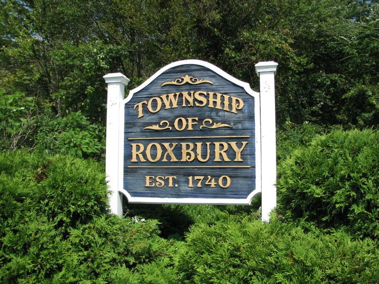
Roxbury Township was formed on December 24, 1740, from portions of Morris Township. It was formally incorporated by the Township Act of 1798 of the New Jersey Legislature on February 21, 1798, as part of the state's initial group of 104 townships. Portions of the township were taken to form Mendham Township (March 29, 1749), Washington Township (April 2, 1798), Chester Township (April 1, 1799), Jefferson Township (February 11, 1804), Mount Olive Township (March 22, 1871), Mount Arlington (November 3, 1890) and Netcong (October 23, 1894).
Tom's Diner was featured in the music video from Time After Time by Cyndi Lauper.
Geography
According to the United States Census Bureau, the township had a total area of 21.888 square miles (56.691 km2), including 20.827 square miles (53.942 km2) of land and 1.061 square miles (2.749 km2) of water (4.85%).
Kenvil (2010 Census population of 3,009) and Succasunna (2010 Census population of 9,152) are unincorporated communities and census-designated places (CDPs)located within the township. As of the 2000 United States Census, the two CDPs were consolidated as Succasunna-Kenvil, which had a 2000 Census population of 12,569.
Other unincorporated communities, localities and place names located partially or completely within the township include Baker Mill Pond, Berkshire Valley, Bertrand Island, Carys, Lake Hopatcong, Lake Junction, Lake Rogerene, Landing, Ledgewood, Port Morris, Port Morris Landing, Rustic and Shippenport.
2010 Census
The 2010 United States Census counted 23,324 people, 8,292 households, and 6,484 families residing in the township. The population density was 1,119.9 per square mile (432.4/km2). The township contained 8,582 housing units at an average density of 412.1 per square mile (159.1/km2). The racial makeup of the township was 88.21% (20,573) White, 2.34% (546) Black or African American, 0.09% (22) Native American, 5.77% (1,346) Asian, 0.05% (12) Pacific Islander, 1.55% (362) from other races, and 1.99% (463) from two or more races. Hispanics or Latinos of any race were 8.93% (2,083) of the population.
Out of a total of 8,292 households, 36.0% had children under the age of 18 living with them, 65.6% were married couples living together, 9.3% had a female householder with no husband present, and 21.8% were non-families. 18.2% of all households were made up of individuals, and 8.0% had someone living alone who was 65 years of age or older. The average household size was 2.80 and the average family size was 3.19.
In the township, 24.6% of the population were under the age of 18, 6.8% from 18 to 24, 23.6% from 25 to 44, 32.4% from 45 to 64, and 12.6% who were 65 years of age or older. The median age was 41.9 years. For every 100 females the census counted 95.8 males, but for 100 females at least 18 years old, it was 92.5 males.
The Census Bureau's 2006-2010 American Community Survey showed that (in 2010 inflation-adjusted dollars) median household income was $95,676 (with a margin of error of +/- $5,626) and the median family income was $110,538 (+/- $6,156). Males had a median income of $75,417 (+/- $7,299) versus $47,556 (+/- $4,775) for females. The per capita income for the borough was $38,576 (+/- $2,305). About 2.5% of families and 3.6% of the population were below the poverty line, including 4.0% of those under age 18 and 5.2% of those age 65 or over.
2000 Census
As of the 2000 United States Census there were 23,883 people, 8,364 households, and 6,532 families residing in the township. The population density was 1,117.4 people per square mile (431.5/km2). There were 8,550 housing units at an average density of 400.0 per square mile (154.5/km2). The racial makeup of the township was 86.57% White, 10.91% Black or African American, 0.15% Native American, 2.58% Asian, 0.07% Pacific Islander, 0.68% from other races, and 0.04% from two or more races. 8.83% of the population were Hispanic or Latino of any race.
There were 8,364 households out of which 39.7% had children under the age of 18 living with them, 66.8% were married couples living together, 8.7% had a female householder with no husband present, and 21.9% were non-families. 17.9% of all households were made up of individuals and 6.5% had someone living alone who was 65 years of age or older. The average household size was 2.84 and the average family size was 3.25.
In the township the population was spread out with 27.0% under the age of 18, 6.1% from 18 to 24, 31.4% from 25 to 44, 25.7% from 45 to 64, and 9.9% who were 65 years of age or older. The median age was 38 years. For every 100 females there were 95.6 males. For every 100 females age 18 and over, there were 92.0 males.
The median income for a household in the township was $72,982, and the median income for a family was $83,409. Males had a median income of $59,488 versus $36,353 for females. The per capita income for the township was $30,174. About 2.1% of families and 2.7% of the population were below the poverty line, including 2.2% of those under age 18 and 3.1% of those age 65 or over.
Crime
According to the 2008 New Jersey State Police Uniform Crime Report, crime had declined in Roxbury Township versus 2007 data. There was an uptick in crime for 2009.
Economy
Ledgewood Mall (with a gross leasable area of 518,246 square feet (48,146.6 m2)) and Roxbury Mall (with a GLA of 706,000 square feet (65,600 m2)) are regional shopping malls located within the township.
Local government
Roxbury Township operates under the Council-Manager form of Government under the Faulkner Act. The Township Council consists of seven elected officials. Council members are elected for four-year terms on a staggered basis from the population in partisan elections, with three at-large seats selected together and one seat from each of four wards elected two years later. The mayor and deputy mayor are chosen from within the council by the members of the council at a reorganization meeting held each year during the first week in January. The manager is responsible for the day-to-day operations associated with all municipal activities. The manager directs, administers and coordinates the activities of the municipality in full support of policies, goals and objectives established by the governing body.
As of 2016, the members of Roxbury's Township Council are Mayor Jim Rilee (R, 2017; at large), Deputy Mayor Mark Crowley (R, 2017; at large), Gary Behrens (R, 2019; Ward 2), Bob DeFillippo (R, 2017; at large), Fred Hall (R, 2019; Ward 3), Daniel Kline (D, 2019; Ward 4) and Richard Zoschak (R, 2019; Ward 1).
Roxbury Mount Arlington Study Commission
In March 2014, members of the public petitioned the New Jersey Department of Community Affairs to form the Roxbury Mount Arlington Study Commission to consider a possible consolidation of Roxbury Township and the neighboring municipality of Mount Arlington. In March 2015, the commission was formed with five members and two alternates from each municipality. If the commission votes to recommend a merger, the decision would have to be ratified by a referendum of the voters in each community.
Federal, state and county representation
Roxbury Township is located in the 7th Congressional District and is part of New Jersey's 25th state legislative district. Prior to the 2010 Census, Roxbury Township had been part of the 11th Congressional District, a change made by the New Jersey Redistricting Commission that took effect in January 2013, based on the results of the November 2012 general elections.
New Jersey's Seventh Congressional District is represented by Leonard Lance (R, Clinton Township). New Jersey is represented in the United States Senate by Cory Booker (D, Newark, term ends 2021) and Bob Menendez (D, Paramus, 2019).
For the 2016–2017 session (Senate, General Assembly), the 25th Legislative District of the New Jersey Legislature is represented in the State Senate by Anthony Bucco (R, Boonton Town) and in the General Assembly by Tony Bucco (R, Boonton Township) and Michael Patrick Carroll (R, Morris Township). The Governor of New Jersey is Chris Christie (R, Mendham Township). The Lieutenant Governor of New Jersey is Kim Guadagno (R, Monmouth Beach).
Morris County is governed by a seven-member Board of Chosen Freeholders, who are elected at-large to three-year terms on a staggered basis, with either two or three seats up for election each year as part of the November general election. The Freeholder Board sets policies for the operation of six super-departments, more than 30 divisions plus authorities, commissions, boards and study committees. Actual day-to-day operation of departments is supervised by County Administrator, John Bonanni. As of 2016, Morris County's Freeholders are Freeholder Director Kathryn A. DeFillippo (Roxbury Township, term ends December 31, 2016), Deputy Freeholder William "Hank" Lyon (Montville, 2017), Douglas Cabana (Boonton Township, 2016), John Cesaro (Parsippany-Troy Hills Township, 2018), Thomas J. Mastrangelo (Montville, 2016) Christine Myers (Mendham Township, 2018), and Deborah Smith (Denville, 2018). Constitutional officers are County Clerk Ann F. Grossi (Parsippany-Troy Hills Township, 2018), Sheriff Edward V. Rochford (Morris Plains, 2016) and Surrogate John Pecoraro (Mendham Borough, 2019).
Politics
As of March 23, 2011, there were a total of 15,471 registered voters in Roxbury Township, of which 3,010 (19.5%) were registered as Democrats, 5,307 (34.3%) were registered as Republicans and 7,145 (46.2%) were registered as Unaffiliated. There were 9 voters registered to other parties.
In the 2012 presidential election, Republican Mitt Romney received 59.9% of the vote (6,536 cast), ahead of Democrat Barack Obama with 39.2% (4,282 votes), and other candidates with 0.9% (100 votes), among the 10,996 ballots cast by the township's 16,262 registered voters (78 ballots were spoiled), for a turnout of 67.6%. In the 2008 presidential election, Republican John McCain received 58.3% of the vote (7,182 cast), ahead of Democrat Barack Obama with 40.2% (4,952 votes) and other candidates with 0.9% (112 votes), among the 12,321 ballots cast by the township's 15,934 registered voters, for a turnout of 77.3%. In the 2004 presidential election, Republican George W. Bush received 61.5% of the vote (7,270 ballots cast), outpolling Democrat John Kerry with 37.3% (4,411 votes) and other candidates with 0.7% (113 votes), among the 11,816 ballots cast by the township's 15,469 registered voters, for a turnout percentage of 76.4.
In the 2013 gubernatorial election, Republican Chris Christie received 69.9% of the vote (4,996 cast), ahead of Democrat Barbara Buono with 27.9% (1,996 votes), and other candidates with 2.2% (154 votes), among the 7,267 ballots cast by the township's 16,060 registered voters (121 ballots were spoiled), for a turnout of 45.2%. In the 2009 gubernatorial election, Republican Chris Christie received 65.3% of the vote (5,306 ballots cast), ahead of Democrat Jon Corzine with 25.6% (2,081 votes), Independent Chris Daggett with 8.0% (646 votes) and other candidates with 0.6% (45 votes), among the 8,120 ballots cast by the township's 15,686 registered voters, yielding a 51.8% turnout.
Education
The Roxbury School District serves public school students in kindergarten through twelfth grade. As of the 2014-15 school year, the district and its seven schools had an enrollment of 3,637 students and 325.5 classroom teachers (on an FTE basis), for a student–teacher ratio of 11.2:1. Schools in the district consists of the following (with 2014-15 enrollment data from the National Center for Education Statistics) are Franklin Elementary School (330 students; in grades K-4), Jefferson Elementary School (334; K-4), Kennedy Elementary School (223; K-4), Nixon Elementary School (283; K-4), Lincoln / Roosevelt School for grades 5 and 6 (544), Eisenhower Middle School for grades 7 and 8 (563) and Roxbury High School for grades 9-12 (1,427).
The district's high school serves students from Roxbury, as well as Mount Arlington, who attend as part of a sending/receiving relationship with the Mount Arlington School District.
Established in 1963, St. Therese School is a Catholic school operated under the auspices of the Roman Catholic Diocese of Paterson.
Roads and highways
As of May 2010, the township had a total of 133.66 miles (215.10 km) of roadways, of which 107.03 miles (172.25 km) were maintained by the municipality, 13.91 miles (22.39 km) by Morris County and 12.72 miles (20.47 km) by the New Jersey Department of Transportation.
Interstate 80, U.S. Route 46, U.S. Route 206, Route 10 and Route 183 all pass through the township.
Public transportation
The NJ Transit Lake Hopatcong station is served by the Morristown Line and the Montclair-Boonton Line, with service to Hoboken Terminal or to Pennsylvania Station in Midtown Manhattan via Midtown Direct which requires a transfer at Dover or Montclair State University.
Morristown & Erie Railway's Chester Branch and High Bridge Branch freight lines run through the township on weekdays.
Port Morris was the starting point for the Lackawanna Cut-Off, an engineering marvel constructed by the Delaware, Lackawanna and Western Railroad between 1908-1911. NJ Transit is considering plans to restore passenger service on the route between the Pocono Mountains in Pennsylvania and Hoboken Terminal.
NJ Transit provides limited local bus service on the 875 route between the Ledgewood Mall, Dover and Morristown.
Lakeland Bus Lines stops in the Landing section of the township providing service to and from the Port Authority Bus Terminal in Midtown Manhattan.
Notable people
People who were born in, residents of, or otherwise closely associated with Roxbury Township include: