
Country United States County Person ZIP codes 27573, 27574 Elevation 218 m Population 8,344 (2013) Number of airports 1 | Time zone Eastern (EST) (UTC-5) Area code(s) 336/743 Area 16.3 km² Local time Thursday 10:54 AM | |
 | ||
Weather 6°C, Wind NE at 11 km/h, 31% Humidity University | ||
215 robertson road roxboro north carolina
Roxboro (/ˈrɒksbʌroʊ/ ROKS-burr-oh) is a city in and the county seat of Person County, North Carolina, United States. The population was 8,362 at the 2010 census. The city is 30 miles (48 km) north of Durham and is a part of the four-county Durham-Chapel Hill Metropolitan Statistical Area, which has a population of 504,357 as of the 2010 Census. The Durham–Chapel Hill MSA is a part of the larger Raleigh-Durham-Cary Combined Statistical Area, which has a population of 1,749,525 as of the 2010 Census.
Contents
- 215 robertson road roxboro north carolina
- Map of Roxboro NC USA
- History
- Geography
- Climate
- City council
- Current statistics
- Businesses
- Demographics
- Education
- Museum
- Entertainment
- Farmers market
- Festivals
- Events
- Performing arts
- Public library
- Parks and recreation
- Shopping
- Air
- Major highways
- Future East Roxboro Bypass
- Railroad
- Public transit
- Utilities
- Print media
- Radio
- Other nearby stations
- Television
- Notable people
- References
Map of Roxboro, NC, USA
History
Roxboro is named after a town in Scotland, Roxburgh. Although spelled differently, they are pronounced the same. Prior to the official adoption of the name Roxboro, the community was known as "Mocassin Gap". The city of Roxboro was incorporated on January 9, 1855 and remains the only municipality in Person County.
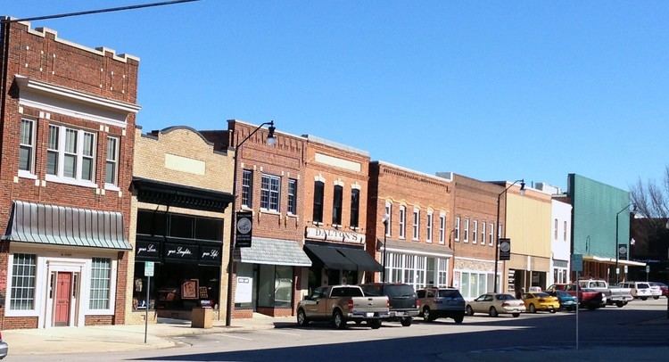
The Holloway-Jones-Day House, House on Wagstaff Farm, James A. and Laura Thompson Long House, Merritt-Winstead House, Person County Courthouse, Roxboro Commercial Historic District, Roxboro Cotton Mill, and Roxboro Male Academy and Methodist Parsonage are listed on the National Register of Historic Places.
Geography
Roxboro is located at 36°23′30″N 78°58′55″W (36.391690, -78.981877).
According to the United States Census Bureau, the city has a total area of 6.3 square miles (16 km2), of which 6.3 square miles (16 km2) is land and 0.16% is water.
Climate
Roxboro has a moderate subtropical climate, with mild weather in the spring, fall, and winter. However, summers can be hot and humid. Winter temperatures generally range from highs in the low 50s°F (10-13 °C) to lows in the upper 20s-mid 30s°F (-2 to 2 °C), though 60 °F (16 °C) degree weather is not uncommon. The record low was -9 °F in January 1985. Spring and fall days are usually in the low to mid 70s°F (low 20s°C), with nights in the 50s°F (10-14 °C). Summer days are often in the upper 80s and low 90s °F (30-35 °C,) with very high humidity. The record high was 104 °F in July 1966. The rainiest months are July and September.
Roxboro receives an average of 7.2 in (183 mm) of snow per winter. Freezing rain and sleet occur most winters, and occasionally the area experiences a major, damaging ice storm. Roxboro is often dubbed the "Snow Capital of the Triangle" because it often receives the most or close to the most snow during snowstorms in central North Carolina
City council
Mayor and City Council members are elected to four-year terms on a non-partisan, at-large basis.
Current statistics
In 2009, 0 murders or non-negligent manslaughters were reported on the Federal Bureau of Investigation's Uniform Crime Reports.
Businesses
Roxboro businesses include LED lighting, law firms, electrical, textile, manufacturing, aerodynamics, administrative, winery, brokering, food processing, automotive, tobacco agriculture, aluminum and paper products. Roxboro is also adjacent to North Carolina's Research Triangle region, home to numerous high-tech companies and enterprises.
Largest employers:
Other businesses:
Demographics
As of the census of 2010 there were 8,362 people, 3,479 households, and 1,979 families residing in the city. The population density was 1,296.2 people per square mile (535.5/km²). There were 4,044 housing units at an average density of 630.8 per square mile (243.5/km²). The racial makeup of the city was 44.9% White, 46.8% African American, 0.6% Native American, 0.4% Asian, 0.01% Pacific Islander, 2.59% from other races, and 2.1% from two or more races. Hispanic or Latino people of any race were 8.7% of the population. (This reporting does not take into account the massive annual influx of Hispanic migrant labor.)
There were 3,479 households out of which 28.1% had children under the age of 18 living with them, 35.2% were married couples living together, 22.0% had a female householder with no husband present, and 38.8% were non-families. 33.8% of all households were made up of individuals and 15.2% had someone living alone who was 65 years of age or older. The average household size was 2.21 and the average family size was 2.76.
In the city the population was spread out with 23.7% under the age of 18, 8.4% from 18 to 24, 29.0% from 25 to 44, 20.8% from 45 to 64, and 18.1% who were 65 years of age or older. The median age was 44.1 years. For every 100 females there were 81.3 males. For every 100 females age 18 and over, there were 77.8 males.
The median income for a household in the city was $36,918 and the median income for a family was $42,559. Males had a median income of $27,741 versus $23,245 for females. The per capita income for the city was $17,824. About 13.4% of families and 16.8% of the population were below the poverty line, including 21.6% of those under age 18 and 14.5% of those age 65 or over.
Education
See Person County, North Carolina.
Museum
Entertainment
Farmers market
Festivals
Events
Performing arts
Public library
Parks and recreation
Person County Parks and Recreation Department offers a wide variety of leisure services throughout the county providing a variety of recreational opportunities including playgrounds, walking tracks, picnic shelters, basketball courts, golf course, putt-putt, bicycling, fishing, swimming, tennis courts, ball fields, volleyball courts, hiking trails, horseshoe pits and restroom facilities at more than 14 sites, more than 6,735 acres (27 km2) of park land, including:
Other attractions include:
Shopping
Air
Major highways
Future East Roxboro Bypass
NCDOT approved the Eastern Roxboro Bypass, a four-lane highway from US Hwy 501 south intersection of Old Durham Road to NC Hwy. 49 north. This project has yet to get underway due to funding.
Railroad
Public transit
Utilities
The city's electric system is maintained by Duke Energy and Piedmont Electric Membership Cooperative. Telephone networks include CenturyLink, wireless networks - AT&T Mobility, U.S. Cellular and Verizon Wireless. Broadband internet is provided by CenturyLink, Electronic Solutions and Charter Communications. Cable television service is available from Charter Communications and CenturyLink.
Print media
Newspapers and periodicals that serve the Roxboro and surrounding area include:
Radio
Roxboro is the city of license for two radio stations:
Other nearby stations
Television
Roxboro is part of the Raleigh-Durham-Fayetteville Designated Market Area, the 24th largest broadcast television market in the United States.