
Country United States FIPS code 19-69060 Elevation 299 m Zip code 52329 Local time Thursday 9:32 AM | Time zone Central (CST) (UTC-6) GNIS feature ID 0460837 Area 93 ha Population 265 (2013) Area code 319 | |
 | ||
Weather 2°C, Wind SE at 31 km/h, 61% Humidity | ||
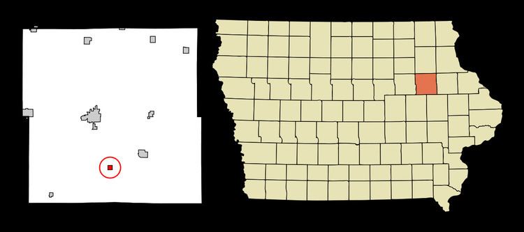
Rowley is a city in Buchanan County, Iowa, United States. The population was 264 at the 2010 census.
Contents
- Map of Rowley IA 52329 USA
- History
- Geography
- 2010 census
- 2000 census
- Constructions
- Notable people
- References
Map of Rowley, IA 52329, USA
History
Rowley was established when the Burlington, Cedar Rapids and Northern Raildroad was built through this area in 1873.
Geography
Rowley is located at 42°22′6″N 91°50′42″W (42.368380, -91.845015).
According to the United States Census Bureau, the city has a total area of 0.36 square miles (0.93 km2), all of it land.
2010 census
As of the census of 2010, there were 264 people, 108 households, and 82 families residing in the city. The population density was 733.3 inhabitants per square mile (283.1/km2). There were 116 housing units at an average density of 322.2 per square mile (124.4/km2). The racial makeup of the city was 99.6% White and 0.4% Native American.
There were 108 households of which 27.8% had children under the age of 18 living with them, 67.6% were married couples living together, 4.6% had a female householder with no husband present, 3.7% had a male householder with no wife present, and 24.1% were non-families. 20.4% of all households were made up of individuals and 5.6% had someone living alone who was 65 years of age or older. The average household size was 2.44 and the average family size was 2.82.
The median age in the city was 41.8 years. 22.3% of residents were under the age of 18; 5.8% were between the ages of 18 and 24; 26.5% were from 25 to 44; 34.9% were from 45 to 64; and 10.6% were 65 years of age or older. The gender makeup of the city was 49.6% male and 50.4% female.
2000 census
As of the census of 2000, there were 290 people, 111 households, and 85 families residing in the city. The population density was 806.3 people per square mile (311.0/km²). There were 114 housing units at an average density of 317.0 per square mile (122.3/km²). The racial makeup of the city was 99.31% White (288 people) and 0.69% Asian (2 people). None of the population is Hispanic or Latino of any race.
There were 111 households out of which 36.0% had children under the age of 18 living with them, 71.2% were married couples living together, 4.5% had a female householder with no husband present, and 23.4% were non-families. 21.6% of all households were made up of individuals and 12.6% had someone living alone who was 65 years of age or older. The average household size was 2.61 and the average family size was 3.06.
In the city, the population was spread out with 26.6% under the age of 18, 7.2% from 18 to 24, 28.3% from 25 to 44, 22.1% from 45 to 64, and 15.9% who were 65 years of age or older. The median age was 40 years. For every 100 females there were 87.1 males. For every 100 females age 18 and over, there were 91.9 males.
The median income for a household in the city was $36,563, and the median income for a family was $41,875. Males had a median income of $35,625 versus $24,375 for females. The per capita income for the city was $17,315. About 6.0% of families and 7.1% of the population were below the poverty line, including 12.0% of those under the age of eighteen and 10.0% of those sixty five or over.
Constructions
The AFLAC Tower, a guyed television transmission tower with a height of 609.6 metres, is among the world's tallest constructions.