
Country United States Time zone Central (CST) (UTC-6) Area 127 ha Population 156 (2013) Area code 641 | State Iowa Elevation 1,211 ft (369 m) FIPS code 19-69015 Zip code 50470 Local time Thursday 7:35 AM | |
 | ||
Weather 2°C, Wind SE at 31 km/h, 62% Humidity | ||
Rowan is a city in Wright County, Iowa, United States. The population was 158 at the 2010 census.
Contents
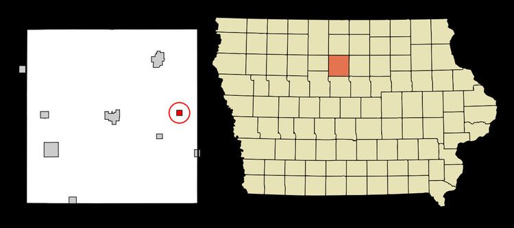
Map of Rowan, IA 50470, USA
Geography
Rowan is located at 42°44′25″N 93°33′4″W (42.740145, -93.551047).
According to the United States Census Bureau, the city has a total area of 0.49 square miles (1.27 km2), all of it land.
2010 census
As of the census of 2010, there were 158 people, 67 households, and 44 families residing in the city. The population density was 322.4 inhabitants per square mile (124.5/km2). There were 95 housing units at an average density of 193.9 per square mile (74.9/km2). The racial makeup of the city was 100.0% White. Hispanic or Latino of any race were 9.5% of the population.
There were 67 households of which 20.9% had children under the age of 18 living with them, 47.8% were married couples living together, 10.4% had a female householder with no husband present, 7.5% had a male householder with no wife present, and 34.3% were non-families. 26.9% of all households were made up of individuals and 12% had someone living alone who was 65 years of age or older. The average household size was 2.36 and the average family size was 2.75.
The median age in the city was 44 years. 19.6% of residents were under the age of 18; 9.4% were between the ages of 18 and 24; 21.5% were from 25 to 44; 26.6% were from 45 to 64; and 22.8% were 65 years of age or older. The gender makeup of the city was 56.3% male and 43.7% female.
2000 census
As of the census of 2000, there were 218 people, 93 households, and 55 families residing in the city. The population density was 387.4 people per square mile (150.3/km²). There were 103 housing units at an average density of 183.1 per square mile (71.0/km²). The racial makeup of the city was 92.20% White, 3.21% Native American, 3.67% from other races, and 0.92% from two or more races. Hispanic or Latino of any race were 6.88% of the population.
There were 93 households out of which 28.0% had children under the age of 18 living with them, 49.5% were married couples living together, 7.5% had a female householder with no husband present, and 39.8% were non-families. 37.6% of all households were made up of individuals and 28.0% had someone living alone who was 65 years of age or older. The average household size was 2.34 and the average family size was 3.14.
Age spread: 28.9% under the age of 18, 4.1% from 18 to 24, 24.8% from 25 to 44, 17.0% from 45 to 64, and 25.2% who were 65 years of age or older. The median age was 39 years. For every 100 females there were 91.2 males. For every 100 females age 18 and over, there were 78.2 males.
The median income for a household in the city was $25,000, and the median income for a family was $34,531. Males had a median income of $26,500 versus $18,750 for females. The per capita income for the city was $13,077. About 5.1% of families and 6.3% of the population were below the poverty line, including none of those under the age of eighteen and 12.3% of those sixty five or over.
Education
Rowan is in the Belmond-Klemme Community School District. Other area schools include the CAL Community School. Belmond-Klemme has an enrollment of about 600 students. CAL (Latimer) has 300 students.