
Length 17.9 km | ||
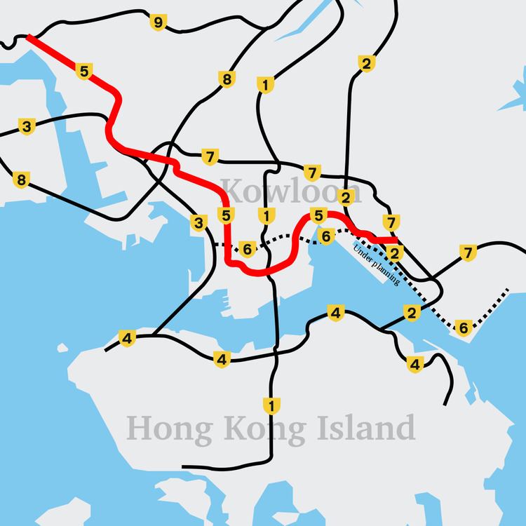 | ||
Existed: 1968 (Lai Chi Kok Bridge) – present East end: Route 7 in Ngau Tau Kok West end: Route 9 near Chai Wan Kok Districts Kwun Tong District, Kowloon City District | ||
Route 5 (Chinese: 五號幹綫) is a route artery in Hong Kong from eastern to western Kowloon and New Kowloon, and ends in Tsuen Wan in the New Territories, linking Route 9.
Map of Kai Fuk Rd, Hong Kong
Part one of the road begins in the east from Kowloon Bay westwards via central Kowloon to Yau Ma Tei.
From Yau Ma Tei the road heads north to Tsuen Wan and meets with Route 9 (Hong Kong).
In the Tai Kok Tsui section of the Route 5 the two lanes are separated.
Route 5 is one of the most seriously congested routes in Kowloon as it serves as an interchange to the Hung Hom Cross Harbour Tunnel, especially during peak hours.
Areas passing through by Route 5 includes:
Roads that are part of it:
There are plans to expand the route to a high-speed roadway to ease congestion within Kowloon to outlying areas in the New Territories and alternate to Route 7 (Hong Kong).