
Length 33 km | ||
 | ||
East end: Highway 40 (Mizpe Rimon) | ||
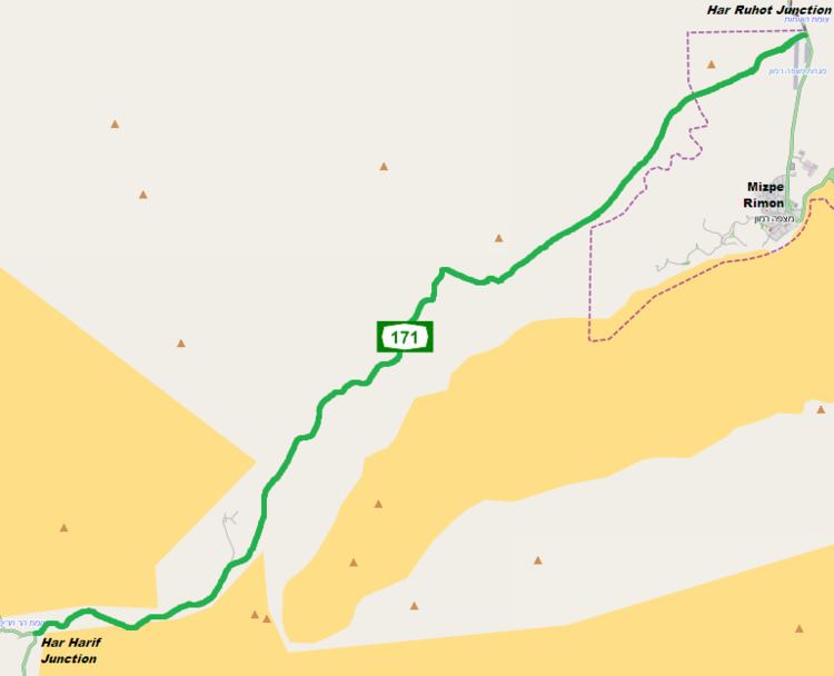
Route 171 is a regional east-west road in southern Israel. It is the only east-west road in the Negev Mountains. It is 33 km long. It goes from Mount Harif (Hebrew: הר חריף) junction on Highway 10 adjacent to Israel's border with Egypt to HaRuhot junction with Highway 40 about 5 km north of Mitzpe Ramon. The road passes mostly along the northern edge of Makhtesh Ramon and along the flowing path of Wadi Nitzana. In its eastern portion it crosses HaRuhot Plain and passes by the Mitzpe Ramon Airport.
Junctions
About 5 km northeast of Har Harif junction, 950 meters above mean sea level, are the Lots cisterns. This is a group of 17 water cisterns spread over an area of 2 square km, that were dug during the reign of Solomon in the 10th century BCE. 15 of the water-pits are still filled with water in the winter rainy season.