
Population 644 (Census 2011) Sovereign state United Kingdom Area 14.06 km² | OS grid reference TF241647 Local time Thursday 8:10 AM | |
 | ||
Weather 8°C, Wind NE at 18 km/h, 91% Humidity | ||
Roughton /ˈruːtən/ is a village and civil parish in the East Lindsey district of Lincolnshire, England. Roughton population (including Dalderby and Martin) in 2011 was 644.
Contents
Map of Roughton, UK
The village is situated approximately 5 miles (8 km) south from Horncastle and near the hamlets of Thornton and Kirkby-on-Bain. Since 1936 the hamlets of Dalderby and Martin have been part of Roughton civil parish.
In the 1086 Domesday Book, Roughton is noted with 11 households, with Lord of the Manor as King William I.
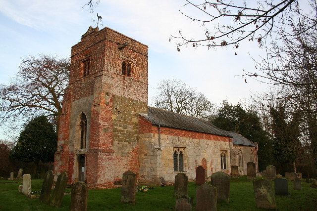
The parish church dates from the 13th century, and is dedicated to Saint Margaret. Built of a "patchwork" of greenstone, limestone and red brick, its construction includes elements from 12th-century Norman to 17th-century brick. It is a Grade II* listed building. The base of a medieval stone cross is in the churchyard; it is both Grade II listed and designated as an ancient scheduled monument.
Roughton Hall is a Grade II* listed building dating from the mid-18th century.
A primary school in Roughton served the village and the nearby hamlets of Haltham, Dalderby and Martin. It closed in December 1946 following a decline of population.
Roughton Moor Wood is a conservation area consisting of semi-natural woodland; it is managed by the Lincolnshire Wildlife Trust.
Governance
An electoral ward in the same name exists. This ward stretches north to Baumber with a total population taken at the 2011 Census of 2,270.