
Founded 1901 | Congressional district At-large Area 13,020 km² Population 9,329 (2013) University Chief Dull Knife College | |
 | ||
Website www.rosebudcountymt.gov | ||
Cultural landscape of the upper tongue river valley in rosebud county montana 2007 12
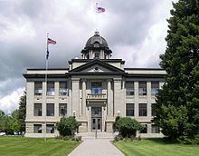
Rosebud County is a county located in the U.S. state of Montana. Rosebud County was established 11 February 1901, and has Montana vehicle license plate prefix 29. As of the 2010 census, the population was 9,233. Its county seat is Forsyth.
Contents
- Cultural landscape of the upper tongue river valley in rosebud county montana 2007 12
- Map of Rosebud County MT USA
- Lame deer rosebud county montana
- Geography
- Major highways
- National protected area
- 2000 census
- 2010 census
- Cities
- Census designated places
- Other communities
- Notable residents
- References
Map of Rosebud County, MT, USA
Lame deer rosebud county montana
Geography
According to the U.S. Census Bureau, the county has a total area of 5,027 square miles (13,020 km2), of which 5,010 square miles (13,000 km2) is land and 17 square miles (44 km2) (0.3%) is water. It is the fourth-largest county in Montana by land area and fifth-largest by total area.
Major highways
National protected area
2000 census
As of the census of 2000, there were 9,383 people, 3,307 households, and 2,417 families residing in the county. The population density was 2 people per square mile (1/km²). There were 3,912 housing units at an average density of 1 per square mile (0/km²). The racial makeup of the county was 64.40% White, 0.23% Black or African American, 32.41% Native American, 0.29% Asian, 0.65% from other races, and 2.01% from two or more races. 2.33% of the population were Hispanic or Latino of any race. 19.8% were of German, 7.2% Irish, 7.1% English and 6.9% Norwegian ancestry. 87.6% spoke English, 8.3% Cheyenne, 1.9% Spanish and 1.0% German as their first language.
There were 3,307 households out of which 38.70% had children under the age of 18 living with them, 56.00% were married couples living together, 11.80% had a female householder with no husband present, and 26.90% were non-families. 24.30% of all households were made up of individuals and 8.40% had someone living alone who was 65 years of age or older. The average household size was 2.81 and the average family size was 3.34.
In the county, the population was spread out with 33.50% under the age of 18, 7.20% from 18 to 24, 25.70% from 25 to 44, 24.80% from 45 to 64, and 8.90% who were 65 years of age or older. The median age was 34 years. For every 100 females there were 100.90 males. For every 100 females age 18 and over, there were 99.20 males.
The median income for a household in the county was $35,898, and the median income for a family was $41,631. Males had a median income of $38,688 versus $20,640 for females. The per capita income for the county was $15,032. About 17.80% of families and 22.40% of the population were below the poverty line, including 31.80% of those under age 18 and 15.10% of those age 65 or over.
2010 census
As of the 2010 United States Census, there were 9,233 people, 3,395 households, and 2,318 families residing in the county. The population density was 1.8 inhabitants per square mile (0.69/km2). There were 4,057 housing units at an average density of 0.8 per square mile (0.31/km2). The racial makeup of the county was 61.3% white, 34.7% American Indian, 0.5% Asian, 0.3% black or African American, 0.5% from other races, and 2.8% from two or more races. Those of Hispanic or Latino origin made up 3.4% of the population. In terms of ancestry, 25.0% were American, 19.0% were German, 6.9% were English, and 6.6% were Irish.
Of the 3,395 households, 36.4% had children under the age of 18 living with them, 51.3% were married couples living together, 10.6% had a female householder with no husband present, 31.7% were non-families, and 27.6% of all households were made up of individuals. The average household size was 2.70 and the average family size was 3.32. The median age was 36.5 years.
The median income for a household in the county was $44,776 and the median income for a family was $56,282. Males had a median income of $52,500 versus $28,306 for females. The per capita income for the county was $19,844. About 13.6% of families and 18.5% of the population were below the poverty line, including 24.7% of those under age 18 and 21.3% of those age 65 or over.