
Barangays ZIP code 8504 Local time Thursday 2:36 AM | Time zone PST (UTC+8) Area 385 km² | |
 | ||
Weather 23°C, Wind W at 0 km/h, 98% Humidity | ||
Rosario, officially the Municipality of Rosario (Cebuano: Lungsod sa Rosario; Filipino: Bayan ng Rosario), is a municipality in the province of Agusan del Sur in the Caraga (Region XIII) of the Philippines. The population was 46,683 at the 2015 census. In the 2016 electoral roll, it had 24,946 registered voters.
Contents
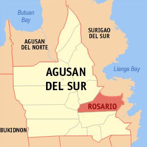
Map of Rosario, Agusan del Sur, Philippines
Rosario was historically part of San Francisco until June 21, 1969, when it became a separate municipality through Republic Act No. 5760. The town was named after its patron saint Nuestra Senora del Rosario.
Geography
Rosario is located at 8°23′N 126°00′E.
According to the Philippine Statistics Authority, the municipality has a land area of 385.05 square kilometres (148.67 sq mi) constituting 7000385000000000000♠3.85% of the 9,989.52-square-kilometre- (3,856.98 sq mi) total area of Agusan del Sur.
Barangays
Rosario is politically subdivided into 11 barangays.
Demographics
In the 2015 census, Rosario had a population of 46,683. The population density was 120 inhabitants per square kilometre (310/sq mi).
In the 2016 electoral roll, it had 24,946 registered voters.