
Area 17.45 km² Population 3,534 (1 Jan 2012) | Postal code 696 01 Elevation 181 m Local time Tuesday 2:57 PM | |
 | ||
Weather 16°C, Wind W at 11 km/h, 48% Humidity | ||
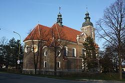
Rohatec is a village and municipality (obec) in Hodonín District in the South Moravian Region of the Czech Republic.
Map of 696 01 Rohatec, Czechia
The municipality covers an area of 17.45 square kilometres (6.74 sq mi), and has a population of 3,496 (as at 31 December 2009).
Rohatec lies approximately 6 kilometres (4 mi) north-east of Hodonín, 55 km (34 mi) south-east of Brno, and 241 km (150 mi) south-east of Prague.
References
Rohatec Wikipedia(Text) CC BY-SA