
Admin. region Schwaben Elevation 512 m (1,680 ft) Area 27.41 km² Population 2,679 (31 Dec 2008) Dialling code 07300 | Time zone CET/CEST (UTC+1/+2) Local time Tuesday 1:45 PM Postal code 89297 Administrative region Swabia | |
 | ||
Weather 13°C, Wind SW at 16 km/h, 53% Humidity | ||
Roggenburg is a municipality in the district of Neu-Ulm in Bavaria in Germany.
Contents
Map of Roggenburg, Germany
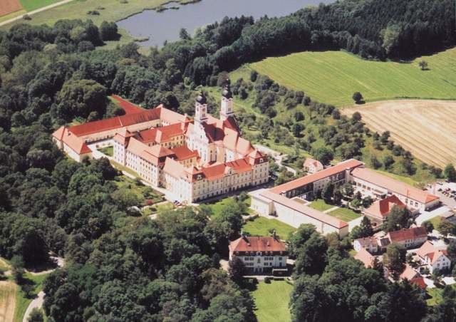
Roggenburg is known for the Roggenburg Abbey, which is used today by the Premonstratensians. An environment and culture center with an overregional commuting area is located near the abbey.
Geographical location
The municipality lies in the region "Donau-Iller" in central Swabia, approximately 30 km southeast of Ulm and 40 km north of Memmingen. The districts Roggenburg, Biberach and Meßhofen are located on the Biber river, the districts Ingstetten, Schießen and Unteregg at the Osterbach, while Schleebuch is located between these two rivers.
Local council
The council has 14 members plus the major.
References
Roggenburg, Bavaria Wikipedia(Text) CC BY-SA