
Country United States FIPS code 01-66216 Elevation 195 m Zip code 35652 Local time Tuesday 7:42 AM | Time zone Central (CST) (UTC-6) GNIS feature ID 0153210 Area 8 km² Population 1,240 (2013) Area code 256 | |
 | ||
Weather 18°C, Wind SW at 6 km/h, 78% Humidity | ||
Rogersville alabama marijuana drug crime attorney drug charge marijuana lawyer rogersville al
Rogersville is a town in Lauderdale County, Alabama, United States. As of the 2010 census, the population of the town is 1,257, up from 1,199 in 2000.
Contents
- Rogersville alabama marijuana drug crime attorney drug charge marijuana lawyer rogersville al
- Map of Rogersville AL 35652 USA
- History
- Geography
- Demographics
- 2010 census
- Notable people
- Gallery
- References
Map of Rogersville, AL 35652, USA
History
The town became an incorporated municipality on February 2, 1858. Originally known as "Rodgersville", it took its name from Andrew and Patience Rodgers of South Carolina who moved into the area and purchased 79.8 acres (323,000 m2) at a public land sale in Huntsville on May 3, 1818. Their land eventually became what is now the downtown business district. When the Rogersville Post Office was established on October 4, 1825 with Thomas Cunningham as the postmaster, the 'd' was dropped from the town's name and it has been known as Rogersville ever since.
The town became a popular trading center due in part to its location near the intersection of three early thoroughfares, U.S. 72, Snake Road and Lamb's Ferry Road. U.S. 72, which now connects Chattanooga and Memphis, Tennessee, was once part of an Indian trail from Ditto's Landing on the Tennessee River south of Huntsville and was used to bypass the Muscle Shoals river barrier. Snake Road leads out of Rogersville into neighboring Limestone County and provided passage from Florence to Athens by way of a shallow ford across Elk River. Lamb's Ferry Road was named for John Lamb who moved from Indian Creek in Giles County, Tennessee in 1816 to establish a ferry across the Tennessee River south of what would later become Rogersville. Lamb's Ferry became an important river port where boats from Knoxville and other points on the upper Tennessee River would unload supplies that were taken over land to areas around Pulaski, TN.
Geography
Rogersville is located at 34°49′24″N 87°17′8″W (34.823444, -87.285693). According to the U.S. Census Bureau, the town has a total area of 3.1 square miles (8.0 km2), all land.
Demographics
As of the census of 2000, there were 1,199 people, 536 households, and 361 families residing in the town. The population density was 389.6 people per square mile (150.3/km²). There were 604 housing units at an average density of 196.3 per square mile (75.7/km²). The racial makeup of the town was 93.08% White, 5.67% Black or African American, 0.17% Native American, 0.42% Asian, 0.08% from other races, and 0.58% from two or more races. 0.42% of the population were Hispanic or Latino of any race.
There were 536 households out of which 26.1% had children under the age of 18 living with them, 51.1% were married couples living together, 12.9% had a female householder with no husband present, and 32.5% were non-families. 31.2% of all households were made up of individuals and 19.0% had someone living alone who was 65 years of age or older. The average household size was 2.24 and the average family size was 2.79.
In the town, the population was spread out with 22.2% under the age of 18, 7.3% from 18 to 24, 24.7% from 25 to 44, 24.4% from 45 to 64, and 21.4% who were 65 years of age or older. The median age was 42 years. For every 100 females there were 83.6 males. For every 100 females age 18 and over, there were 79.8 males.
The median income for a household in the town was $29,779, and the median income for a family was $37,639. Males had a median income of $30,852 versus $18,571 for females. The per capita income for the town was $16,435. About 10.2% of families and 14.3% of the population were below the poverty line, including 19.2% of those under age 18 and 15.7% of those age 65 or over.
2010 census
As of the census of 2010, there were 1,257 people, 555 households, and 342 families residing in the town. The population density was 405.5 people per square mile (157.1/km²). There were 639 housing units at an average density of 206.1 per square mile (79.9/km²). The racial makeup of the town was 91.2% White, 6.1% Black or African American, 1.0% Native American, 0.6% Asian, 0.2% from other races, and 0.8% from two or more races. 1.7% of the population were Hispanic or Latino of any race.
There were 555 households out of which 24.7% had children under the age of 18 living with them, 44.3% were married couples living together, 13.2% had a female householder with no husband present, and 38.4% were non-families. 34.6% of all households were made up of individuals and 18.9% had someone living alone who was 65 years of age or older. The average household size was 2.26 and the average family size was 2.94.
In the town, the population was spread out with 22.1% under the age of 18, 7.5% from 18 to 24, 23.4% from 25 to 44, 25.1% from 45 to 64, and 22.0% who were 65 years of age or older. The median age was 43 years. For every 100 females there were 87.9 males. For every 100 females age 18 and over, there were 92.6 males.
The median income for a household in the town was $32,727, and the median income for a family was $44,803. Males had a median income of $44,219 versus $38,229 for females. The per capita income for the town was $19,605. About 12.2% of families and 12.8% of the population were below the poverty line, including 12.5% of those under age 18 and 10.8% of those age 65 or over.
Notable people
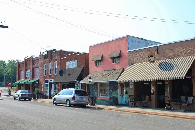
Gallery
Below are photographs taken in Rogersville as part of the Historic American Buildings Survey: