
Area 246 km² | Phone +1 573-546-2450 | |
 | ||
Address County Rd 19-250, Salem, MO 65560, USA Similar Clark's Hill/Norton State Hist, Morris State Park, Current River State Park, Gov Daniel Dunklin's, Jewell Cemetery State Hist | ||
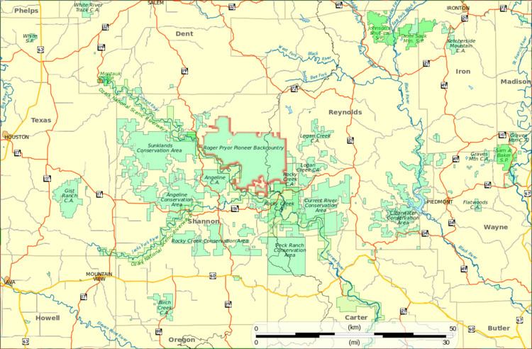
The Roger Pryor Pioneer Backcountry is a 61,000-acre (247 km2) area of private land that is managed by the Missouri Department of Natural Resources for hiking and backpacking by the public. The land is part of the largest private forest in the state, the Pioneer Forest, owned by the L-A-D Foundation endowed by former owner Leo Drey.
The area is crossed by 27 miles (43 km) of trails: the 13-mile (21 km) Blair Creek Section of the Ozark Trail, the 12-mile (19 km) Brushy Creek Trail, and a 2-mile (3.2 km) Laxton Hollow Trail, which connects to the Ozark Trail. An additional trail is under construction, the Current River Trail will eventually connect the new Round Spring State Park, which is a few miles west of the backcountry area, to Brushy Creek Trail.
Two significant wilderness areas are included in the managed area: the Current River Natural Area contains 400-year-old trees, and the Pioneer Natural Area adjacent to the Current River is home to old-growth cedar and hardwood trees.