
Population 830 (2011) Civil parish Rodington Ceremonial county Shropshire Local time Tuesday 8:30 AM UK parliament constituency The Wrekin | OS grid reference SJ588143 Unitary authority Region West Midlands Dialling code 01952 | |
 | ||
Weather 5°C, Wind SW at 23 km/h, 70% Humidity | ||
Rodington is a village in Shropshire, England. Situated between the towns of Wellington and Shrewsbury it lies on the relatively level Shropshire plain and just within the borough of Telford & Wrekin.
Map of Rodington, Shrewsbury, UK
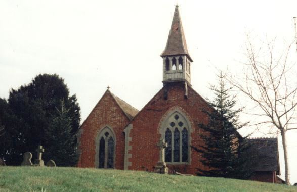
The Church of England parish church, St George's, although listed in the Domesday Book was extensively re-built in the Victorian era. Its deanery is Wrockwardine and its Diocese Lichfield.
The village pub, the Bull has changed ownership a number of times in recent years. Having been closed for refurbishment for a long time, it re-opened in October 2007.
Rodington village hall is one of the larger venues in the immediate area, it contains a main room with stage, dressing rooms, a bar, a kitchen and also contains the village post office. The hall is available for renting for private functions and normally runs a variety of concerts every two or three weeks through the winter season.
The River Roden flows through the village and visible in some of the fields are the remains of the Shropshire Canal.