
Country United States County Franklin Time zone Eastern (EST) (UTC-5) Elevation 366 m Population 4,830 (2013) | Founded 1786 FIPS code 51-68496 Zip code 24151 Local time Tuesday 2:06 AM | |
 | ||
Weather 11°C, Wind S at 3 km/h, 73% Humidity | ||
Rocky Mount is a town in and the county seat of Franklin County, Virginia, United States. The town is part of the Roanoke Metropolitan Statistical Area, and had a population of 4,799 as of the 2010 census. It is located in the Roanoke Region of Virginia.
Contents
- Map of Rocky Mount VA 24151 USA
- Grassy hill natural area preserve in rocky mount virginia
- History
- Geography
- Climate
- Demographics
- Notable people
- References
Map of Rocky Mount, VA 24151, USA
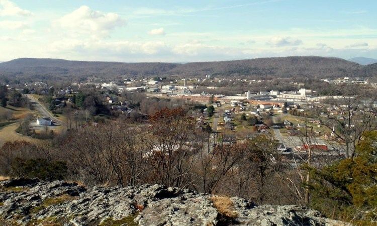
Grassy hill natural area preserve in rocky mount virginia
History
The first English colonists arrived here in 1760, and they named Rocky Mount for a steep cliff near the town. The area originally consisted of two adjacent villages, Rocky Mount and Mount Pleasant. The first court was held at Rocky Mount in 1786 following the Revolutionary War. The first courthouse, made of logs, was replaced in 1831. By 1836 the town consisted of 30 homes and several businesses.
During the Civil War, numerous planter families from the Tidewater region sought refuge in Rocky Mount, and many brought substantial numbers of slaves with them. Among these were the immediate past governor, Henry A. Wise, who settled his family here before he served in the military. The Confederate General Jubal Anderson Early, born on a farm nearby, practiced law in Rocky Mount before and after the war.
In 1873, Rocky Mount absorbed the smaller village of Mount Pleasant, creating the present boundaries of the town, and it was incorporated that year. The present Franklin County courthouse was constructed in 1909 at Rocky Mount.
The Booker T. Washington National Monument, Evergreen-Callaway-Deyerle House, The Farm, Greer House, Rocky Mount Historic District, Washington Iron Furnace, and Woods-Meade House are listed on the National Register of Historic Places.
Geography
Rocky Mount is located at the center of Franklin County at 36°59′59″N 79°53′23″W (36.999855, -79.889673). U.S. Route 220 passes through the east side of town as a limited-access bypass, leading north 23 miles (37 km) to Roanoke and south 26 miles (42 km) to Martinsville. Virginia State Route 40 passes through the center of Rocky Mount as Pell Avenue and Franklin Street, leading east 32 miles (51 km) to Gretna and southwest 10 miles (16 km) to Ferrum.
According to the United States Census Bureau, the town has a total area of 6.9 square miles (17.8 km2), of which 0.03 square miles (0.07 km2), or 0.39%, is water. The Pigg River, an east-flowing tributary of the Roanoke River, forms the southern border of the town. The 1,934-foot (589 m) summit of Grassy Hill is in the northern part of town.
Climate
The climate in this area is characterized by hot, humid summers and generally mild to cool winters. According to the Köppen Climate Classification system, Rocky Mount has a humid subtropical climate, abbreviated "Cfa" on climate maps.
Demographics
As of the census of 2000, there were 4,066 people, 1,698 households, and 1,018 families residing in the town. The population density was 886.5 people per square mile (342.0/km²). There were 1,796 housing units at an average density of 391.6 per square mile (151.1/km²). The racial makeup of the town was 74.50% White, 22.26% African American, 0.27% Native American, 1.11% Asian, 0.10% Pacific Islander, 0.49% from other races, and 1.28% from two or more races. Hispanic or Latino of any race were 1.67% of the population.
There were 1,698 households out of which 26.4% had children under the age of 18 living with them, 40.2% were married couples living together, 15.8% had a female householder with no husband present, and 40.0% were non-families. 36.5% of all households were made up of individuals and 18.7% had someone living alone who was 65 years of age or older. The average household size was 2.21 and the average family size was 2.87.
In the town, the population was spread out with 21.4% under the age of 18, 7.7% from 18 to 24, 25.2% from 25 to 44, 22.1% from 45 to 64, and 23.6% who were 65 years of age or older. The median age was 42 years. For every 100 females there were 85.0 males. For every 100 females age 18 and over, there were 81.1 males.
The median income for a household in the town was $26,927, and the median income for a family was $38,688. Males had a median income of $30,947 versus $22,472 for females. The per capita income for the town was $16,207. About 16.6% of families and 14.1% of the population were below the poverty line, including 17.6% of those under age 18 and 14.0% of those age 65 or over.