
Local time Tuesday 1:54 AM | ||
 | ||
Weather 12°C, Wind W at 13 km/h, 77% Humidity | ||
Rocky Gap is an unincorporated community that is located in Bland County in the U.S. state of Virginia. Rocky Gap's center sits at a high elevation of around 2,887 ft. In the year of 2009, there was an estimate that there were a total of 75 people living in Rocky Gap. Rocky Gap has one zip code (24366).
Contents
Map of Rocky Gap, VA 24366, USA
Geography
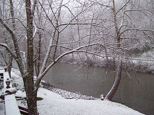
Rocky Gap is located about 8 miles from Bluefield, WV. Rocky Gap has a total area of 4 miles and 95% of it is land the other 5% is water. Although only 5% water, Rocky Gap is somewhat unusual in that the waters of Clear Fork, Laurel Fork and Wolf Creek all converge at nearly the same point less than a hundred yards from each other. This spot where the three waters meet is well known for large trout and has been a favorite spot for many anglers from all over Virginia and West Virginia.
Nearby cities and towns
Here are the nearest cities and towns in order by nearest location.