
- elevation 459 ft (140 m) - elevation 3 ft (1 m) | - location near Depot Bay | |
 | ||
- location Central Oregon Coast Range | ||
Rocky Creek is a short coastal stream in Lincoln County in the U.S. state of Oregon. It begins near the western extremities of the Central Oregon Coast Range and flows generally west to the ocean south of Depot Bay and north of Otter Rock. It has no named tributaries.
Map of Rocky Creek, Oregon, USA
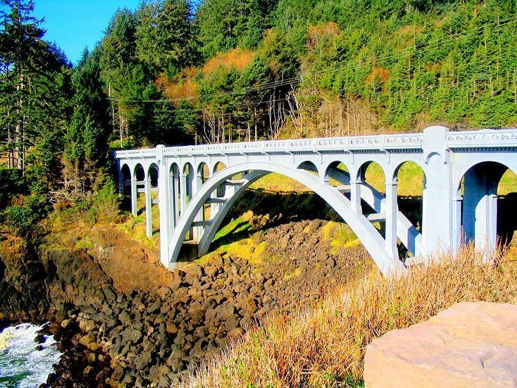
The creek passes under U.S. Route 101 and then Otter Crest Loop Road shortly before entering the ocean. Rocky Creek Bridge No. 01089, also known as the Ben Jones Bridge, carries the loop road over the creek immediately upstream of the creek mouth. The bridge was added to the National Register of Historic Places in 2005.
Rocky Creek State Scenic Viewpoint, a 58-acre (23 ha) state park, lies along a bluff between Whale Cove and Rocky Creek. The park extends south along the Otter Crest Loop Road to the Rocky Creek Bridge. The park, which is open year-round for day use, has picnic tables, parking spaces, and restrooms. Attractions include watching for whales, waves, and ocean birds along a rocky coast, and hiking through a forest of shore pines.