
Seat Rock Island Congressional district 17th Area 1,169 km² Population 147,258 (2013) | Largest city Moline Time zone Central: UTC-6/-5 Founded 1831 | |
 | ||
Website www.co.rock-island.il.us Rivers Mississippi River, Deerlick Branch, Rock River Destinations Mississippi River, Moline, Rock Island Colleges and Universities Augustana College, Black Hawk College, Trinity College of Nursing a, Midwest Technical Institute, La James International College Points of interest Niabi Zoo, Jumer's Casino & Hotel, John Deere World He, John Deere Pavilion, Quad City Botanical Center | ||
Rock Island County is a county located in the U.S. state of Illinois, bounded on the west by the Mississippi River. According to the 2010 census, it had a population of 147,546. Its county seat is Rock Island; its largest city is neighboring Moline.
Contents
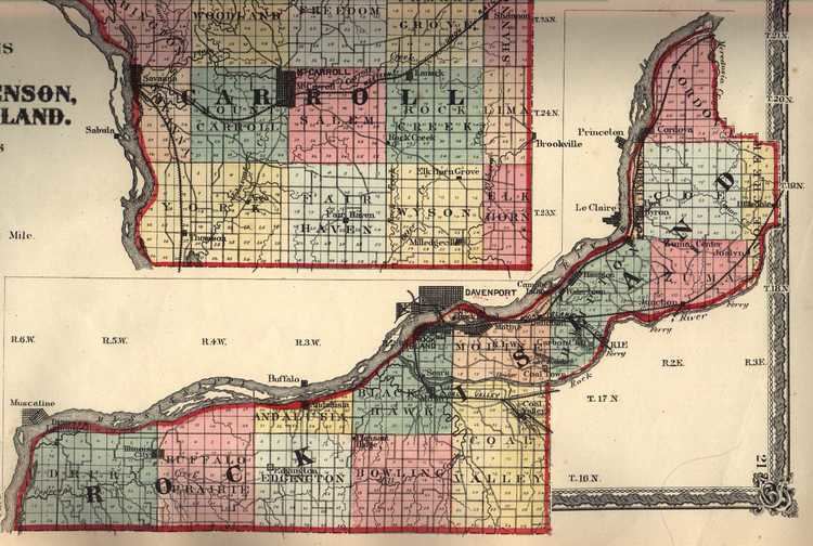
- Map of Rock Island County IL USA
- History
- Geography
- Climate and weather
- Adjacent counties
- National protected area
- Demographics
- Economy
- Cities
- Census designated places
- Unincorporated communities
- Townships
- References
Map of Rock Island County, IL, USA
Rock Island County is one of the four counties that make up the Davenport-Moline-Rock Island, IA-IL Metropolitan Statistical Area.
History
Rock Island County was formed in 1831 out of Jo Daviess County. It was named for Rock Island, an island in the Mississippi River now known as Arsenal Island.
Geography
According to the U.S. Census Bureau, the county has a total area of 451 square miles (1,170 km2), of which 428 square miles (1,110 km2) is land and 24 square miles (62 km2) (5.2%) is water.
Climate and weather
In recent years, average temperatures in the county seat of Rock Island have ranged from a low of 13 °F (−11 °C) in January to a high of 85 °F (29 °C) in July, although a record low of −22 °F (−30 °C) was recorded in February 1996 and a record high of 103 °F (39 °C) was recorded in July 2006. Average monthly precipitation ranged from 1.28 inches (33 mm) in January to 4.75 inches (121 mm) in June.
Adjacent counties
National protected area
Demographics
As of the 2010 United States Census, there were 147,546 people, 61,303 households, and 38,384 families residing in the county. The population density was 345.0 inhabitants per square mile (133.2/km2). There were 65,756 housing units at an average density of 153.8 per square mile (59.4/km2). The racial makeup of the county was 81.6% white, 9.0% black or African American, 1.6% Asian, 0.3% American Indian, 4.4% from other races, and 3.0% from two or more races. Those of Hispanic or Latino origin made up 11.6% of the population. In terms of ancestry, 25.9% were German, 14.2% were Irish, 8.7% were English, 6.8% were Swedish, and 5.2% were American.
Of the 61,303 households, 29.0% had children under the age of 18 living with them, 45.3% were married couples living together, 12.7% had a female householder with no husband present, 37.4% were non-families, and 31.6% of all households were made up of individuals. The average household size was 2.34 and the average family size was 2.93. The median age was 40.0 years.
The median income for a household in the county was $46,226 and the median income for a family was $58,962. Males had a median income of $42,548 versus $31,917 for females. The per capita income for the county was $25,071. About 8.7% of families and 12.3% of the population were below the poverty line, including 19.0% of those under age 18 and 7.1% of those age 65 or over.
Economy
At one time Mississippi Valley Airlines had its headquarters in Quad City Airport in the county. John Deere is headquartered in Moline.
Cities
Census-designated places
Unincorporated communities
Townships
Rock Island County is divided into eighteen townships: