
Country United States County Le Flore FIPS code 40-63600 Elevation 151 m Population 638 (2013) | Time zone Central (CST) (UTC-6) GNIS feature ID 1097351 Local time Monday 7:03 PM | |
 | ||
Weather 29°C, Wind SW at 18 km/h, 32% Humidity Area 31.6 km² (31.34 km² Land / 26 ha Water) | ||
Rock Island is a town in Le Flore County, Oklahoma, United States. It is part of the Fort Smith, Arkansas-Oklahoma Metropolitan Statistical Area. The population was 646 at the 2010 census, a decline of 8.9 percent from 709 at the 2000 census.
Contents
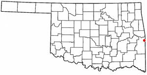
Map of Rock Island, OK, USA
History
The Fort Smith and Southern Railway built a north-south line through what is now Le Flore County in 1896. The Midland Valley Railroad built an east-west line the following year. The settlement that began evolving at the crossing was originally called Maxey Junction. A post office established in the community was named "Rock Island" by the U. S. Post Office Department, and the town was renamed in 1905.
Rock Island started the process of incorporation in 1989, but the County Commissioners did not approve the incorporation until 2004.
Geography
Rock Island is located at 35°10′58″N 94°28′37″W (35.182759, -94.477029). It is 13 miles (21 km) northeast of Poteau.
According to the United States Census Bureau, the town has a total area of 12.2 square miles (32 km2), of which, 12.1 square miles (31 km2) of it is land and 0.1 square miles (0.26 km2) of it (0.66%) is water.
Economy
Rock Island's economy has depended on agriculture since its founding. Many residents now commute to work in nearby towns such as Poteau and Fort Smith.
Railroad Tunnel
Jenson Tunnel is located just northeast of Rock Island and is the only known railroad tunnel in Oklahoma. Now used by the Kansas City Southern, it was built by Frisco Railway in 1885 and is approximately 1,180 feet long.
Demographics
As of the census of 2000, there were 709 people, 264 households, and 213 families residing in the town. The population density was 58.6 people per square mile (22.6/km²). There were 279 housing units at an average density of 23.1 per square mile (8.9/km²). The racial makeup of the town was 87.73% White, 5.64% Native American, 0.14% Asian, 0.56% from other races, and 5.92% from two or more races. Hispanic or Latino of any race were 1.97% of the population.
There were 264 households out of which 40.2% had children under the age of 18 living with them, 67.0% were married couples living together, 7.6% had a female householder with no husband present, and 19.3% were non-families. 16.3% of all households were made up of individuals and 7.2% had someone living alone who was 65 years of age or older. The average household size was 2.69 and the average family size was 3.02.
In the town, the population was spread out with 29.1% under the age of 18, 8.6% from 18 to 24, 28.2% from 25 to 44, 25.4% from 45 to 64, and 8.7% who were 65 years of age or older. The median age was 36 years. For every 100 females there were 115.5 males. For every 100 females age 18 and over, there were 107.0 males.
The median income for a household in the town was $30,625, and the median income for a family was $34,545. Males had a median income of $26,442 versus $18,625 for females. The per capita income for the town was $14,115. About 8.9% of families and 11.5% of the population were below the poverty line, including 11.6% of those under age 18 and 11.4% of those age 65 or over.