
FIPS code 55-68575 Elevation 249 m Local time Monday 5:13 PM | Time zone Central (CST) (UTC-6) GNIS feature ID 1584047 Population 3,693 (2013) Area code 262 | |
 | ||
Weather 11°C, Wind NE at 26 km/h, 62% Humidity Area 45.95 km² (45.27 km² Land / 67 ha Water) | ||
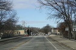
Rochester is a village in Racine County, Wisconsin, United States. The population was 3,682 at the 2010 census. The village was located within the old Town of Rochester. The community of Honey Lake was located partially in the town of Rochester. On November 4, 2008, the village of Rochester voted to consolidate with the town of Rochester.
Contents
Map of Rochester, WI, USA
History
The first non-Native American settlers in Rochester were a group of five farming families, who all hailed from the town of Rochester, Vermont after which they gave their new settlement its name. These were "Yankee" settlers, that is to say they were descended from the English Puritans who settled New England during the colonial era. Correspondingly they were members of the Congregationalist Church and were staunch abolitionists. When they arrived in what is now Rochester there was nothing but dense virgin forest and wild prairie. They laid out post routes, built roads, constructed farms and government buildings all within the first few months of settling in what is now Rochester. The old Union House hotel in the Village of Rochester was a part of the Underground Railroad. The trail started there, went under the Fox River, and ended at a house on the other side.
Geography
Rochester is located at 42°44′26″N 88°13′26″W (42.740585, -88.224108).
According to the United States Census Bureau, the village has a total area of 17.74 square miles (45.95 km2), of which, 17.48 square miles (45.27 km2) of it is land and 0.26 square miles (0.67 km2) is water.
2010 census
As of the census of 2010, there were 3,682 people, 1,343 households, and 1,069 families residing in the village. The population density was 210.6 inhabitants per square mile (81.3/km2). There were 1,412 housing units at an average density of 80.8 per square mile (31.2/km2). The racial makeup of the village was 97.8% White, 0.2% African American, 0.3% Native American, 0.5% Asian, 0.1% Pacific Islander, 0.5% from other races, and 0.6% from two or more races. Hispanic or Latino of any race were 2.8% of the population.
There were 1,343 households of which 35.6% had children under the age of 18 living with them, 67.4% were married couples living together, 7.7% had a female householder with no husband present, 4.5% had a male householder with no wife present, and 20.4% were non-families. 15.6% of all households were made up of individuals and 5% had someone living alone who was 65 years of age or older. The average household size was 2.72 and the average family size was 3.04.
The median age in the village was 42 years. 24.5% of residents were under the age of 18; 6.4% were between the ages of 18 and 24; 23.5% were from 25 to 44; 34.9% were from 45 to 64; and 10.5% were 65 years of age or older. The gender makeup of the village was 51.1% male and 48.9% female.
2000 census
As of the census of 2000, there were 1,149 people, 410 households, and 307 families residing in the village. The population density was 2,360.6 people per square mile (905.4/km²). There were 425 housing units at an average density of 873.1 per square mile (334.9/km²). The racial makeup of the village was 97.30% White, 0.09% Black or African American, 0.35% Native American, 0.17% Asian, 0.70% from other races, and 1.39% from two or more races. 3.48% of the population were Hispanic or Latino of any race.
There were 410 households out of which 43.2% had children under the age of 18 living with them, 61.7% were married couples living together, 9.5% had a female householder with no husband present, and 24.9% were non-families. 19.8% of all households were made up of individuals and 6.3% had someone living alone who was 65 years of age or older. The average household size was 2.80 and the average family size was 3.22.
In the village, the population was spread out with 30.5% under the age of 18, 7.5% from 18 to 24, 33.3% from 25 to 44, 21.8% from 45 to 64, and 6.8% who were 65 years of age or older. The median age was 35 years. For every 100 females there were 108.5 males. For every 100 females age 18 and over, there were 100.5 males.
The median income for a household in the village was $55,063, and the median income for a family was $61,875. Males had a median income of $42,159 versus $30,184 for females. The per capita income for the village was $21,609. About 4.9% of families and 4.7% of the population were below the poverty line, including 5.6% of those under age 18 and 10.8% of those age 65 or over.